Whangarei
17.89°C

Whangarei
17.89°C
Waitakere City
16.98°C
Manukau City
17.11°C

Papakura
24.46°C
Hauraki
17.26°C

Waikato
17.67°C
Matamata
18.46°C
Hamilton
17.51°C
Otorohanga
18.52°C
Rotorua
16.6°C
Taupo
15.44°C
Tauranga
19.27°C
Kawerau
18.6°C
Whakatane
19.64°C
Gisborne
15.51°C
New Plymouth
16.98°C

Stratford
8.97°C
Ruapehu
14°C
Wanganui
17°C
Palmerston North
16.41°C
Wairoa
19.19°C
Hastings
18.84°C
Napier
18.49°C
Masterton
15.49°C
Carterton
15.66°C
Porirua
15.99°C
Lower Hutt
16.45°C

Wellington
15.79°C

Tasman
9.35°C
Nelson
16.27°C
Marlborough
3.22°C
Kaikoura
15.48°C
Christchurch
12.59°C
Ashburton
12.52°C
Timaru
13.37°C
Waitaki
11.32°C
Waimate
13.08°C

Queenstown
12.38°C
Dunedin
14.33°C
Southland
9.98°C
Gore
11.31°C
Invercargill
12.06°C
Blenheim
14.73°C
Te Anau
27.35°C
Wanaka
11.17°C
Kaikoura
13.38°C
Stratford
13.54°C
Upper Hutt
15.9°C
About


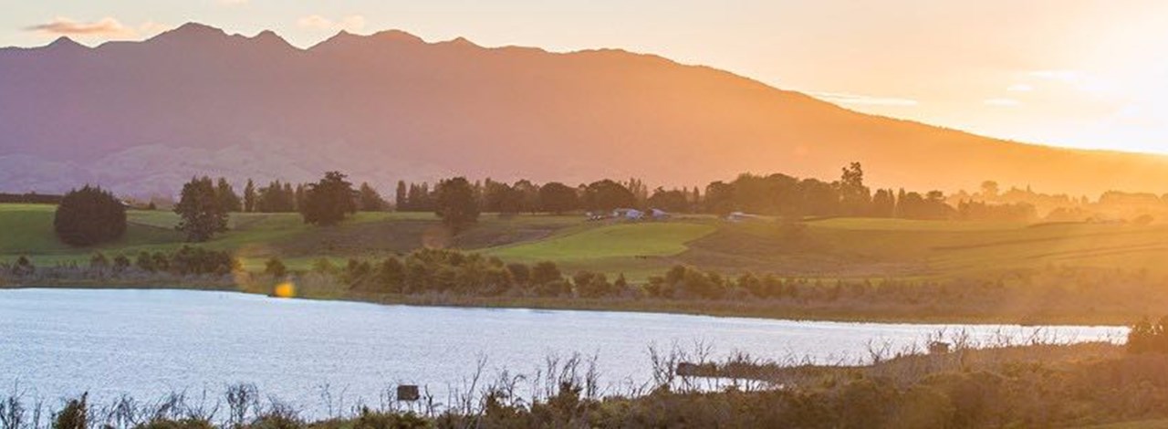
The South Island main trunk line linked Christchurch and Dunedin by 1878 and was extended to Invercargill the next year, but another three decades would pass before engineers and politicians could overcome the opposition of King Country Māori and the forbidding central North Island terrain to complete the northern equivalent. Until then anyone wanting to travel from Auckland to Wellington either took a steamer down the east coast or sailed from Onehunga to catch the Wellington train at New Plymouth.
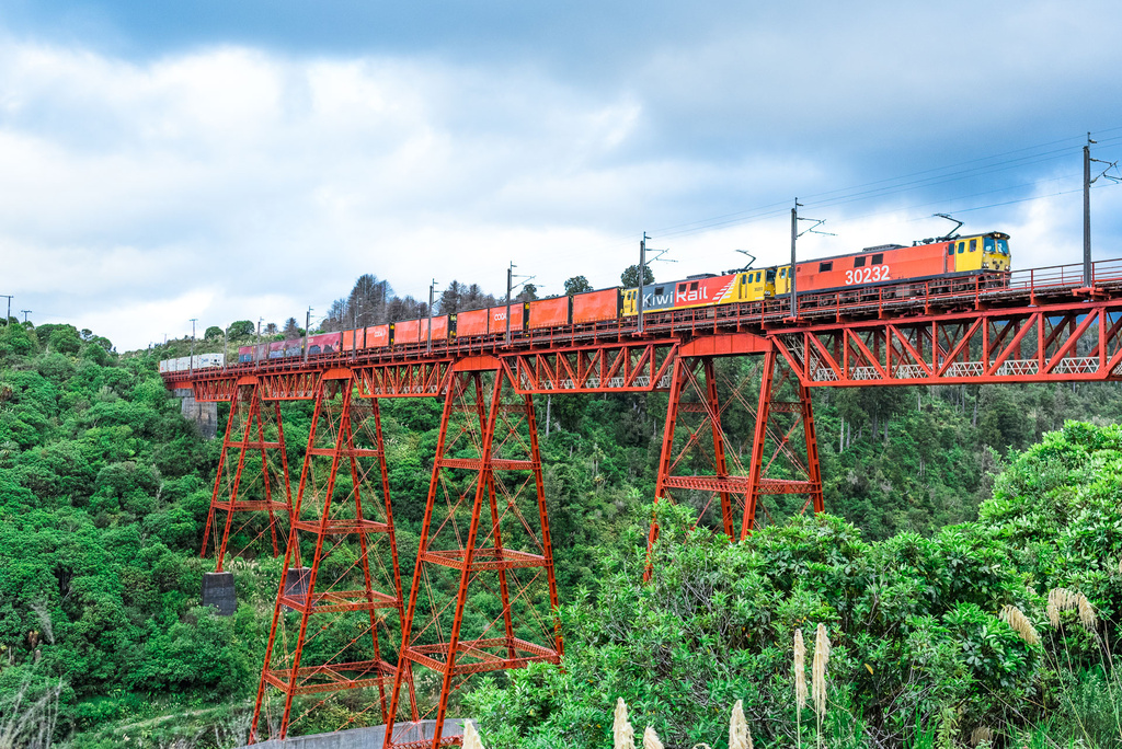
Christchurch firm J. & A. Anderson won the Makatote construction tender in 1905. The site was forbidding, 792 m above sea level amid thickly forested hills. Storms, floods and shortages of cement and skilled labour made things worse. Anderson set up a fully equipped workshop and brought in 1238 tonnes of cement and 1016 tonnes of steel by wagon from the railhead. Using a cableway stretched across the gorge between timber gantries, they had the viaduct ready by July 1908. Soon trains began rolling uninterrupted between Auckland and Wellington, transforming travel in the North Island and turning the government railway into a modern main-line system. Passenger numbers soared from 3.5 million in 1895 to 13.3 million in 1913 and freight carried rose from 2 million tonnes in 1895 to almost 3.9 million tonnes in 1913.
The Makatote Viaduct is not our longest railway viaduct, but still offers some impressive statistics: it is 262 m long and 79 m high. There are six concrete and five steel piers. Twenty-three major viaducts and 26 bridges made the North Island main trunk an impressive project by any standards. When the American Society of Civil Engineers awarded the line its 27th International Historic Civil Engineering Landmark Award in 1997, it joined the Statue of Liberty, the Eiffel Tower and the Panama Canal on a very select list. Just south of the viaduct, the Last Spike Monument marks the spot where Sir Joseph Ward drove the final spike into the line on 6 November 1908.
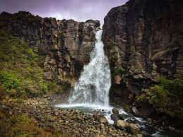
Tawhai Falls is a 13 metre high waterfall located in the UNESCO Dual World Heritage Tongariro National Park.
The track begins 4km below Tongariro National Park Visitor Centre in Whakapapa Village on SH48 and is an easy 10-15 minute walk to the waterfall's lookout.
The walk is along a track and down steps through mountain toatoa and beech forest. The beautiful falls tumble over the edge of an ancient lava flow.
Tawhai Falls is also the filming location of Gollum’s pool where Faramir and his archers are watching Gollum fish. If you use your imagination, you can just about hear Gollum singing his song as he fishes in the pool at the bottom of the falls!
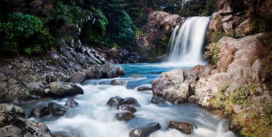
One of Tongariro National Park’s best short walks, this easy loop is jam-packed with fascinating natural sights including Taranaki Falls themselves which tumble 20 metres into a boulder-ringed pool.
The track is in two parts – an upper and lower – which form a loop with the falls around the halfway mark.
The lower track passes through tussock, alpine shrublands, and beech forest where you may see cute native birds. After a while, it meets the pretty Wairere Stream and climbs past Cascade Falls before Taranaki Falls come into view.
The falls tumble over an ancient lava flow formed by the Ruapehu eruption of 15,000 years ago.
From the falls, the track climbs through forest to join the Tama Lakes Track, crossing interesting old lava flows as it goes. As it meanders back to Whakapapa it passes through tussock and manuka as it crosses a series of eroded gullies, their layers telling of successive eruptions.
Highlights include lava formations, mountain beech trees, native ferns, waterfalls, golden silica rapids and wonderful views of Mt Ngauruhoe and Mt Ruapehu.
The Silica Rapids walk is an easy 7km loop track that will take you around 2.5 hours return.
The track begins 250 metres above Whakapapa Visitor Centre in Whakapapa Village.
Through mountain beech forest, the track travels alongside a cascading stream, arriving at the creamy-white terraces of Silica Rapids. Subalpine plants, amid a mixture of swamp and tussock country, feature around the track as it returns to the Bruce Road 2.5 kilometres above the starting point. This highly varied walk reveals a range of vegetation types and also has spectacular views of Ruapehu and Ngauruhoe on a clear day.
This track is an extension of the Taranaki Falls Walking Track.
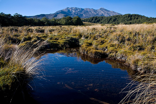
After reaching Taranaki Falls, the track crosses undulating tussock country and alpine herb fields on a well formed and marked track. Further on, the track branches to the left to Tama Lakes, while the main track continues on to Waihohonu Hut. From this junction is a view of the lower lake (1,240 metres) with a surrounding backdrop of Mt Ngauruhoe to the North and behind you Mt Ruapehu.
The track climbs steeply to a viewpoint of the upper lake (1,440 metres). From here the track is not formed and is made of loose and uneven rock. There are no formed tracks down to the lakes, the descent to both is via steep unstable gullies. To ensure these pristine alpine lakes are kept free of weeds, do not touch or swim in the water.
This track requires much less uphill walking and exposure to alpine conditions than the Tongariro Alpine Crossing. It may be a great alternative during periods of bad weather.
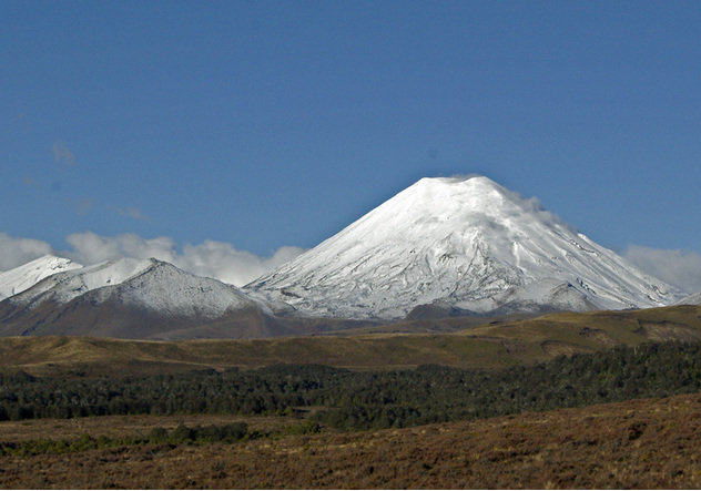
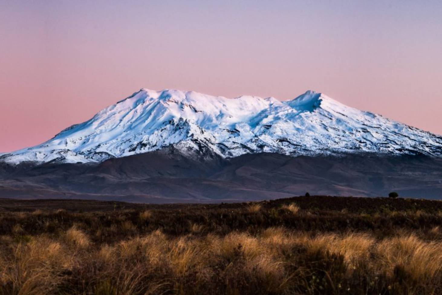
Ngauruhoe (7,500 ft) has an almost perfect cone rising 3,000 ft above the southern slopes of Tongariro. It has been the most continuously active of New Zealand volcanoes in the recent past. Eruptions from this mountain were regarded by the Maori as a sign of war. Except on the east, young lava flows have reached their base on all sides and these have a loose, rugged, clinkery surface. Since 1839 considerable changes have occurred within the crater. The more notable eruptions were in 1841 with ash eruption which truncated the top, in 1855 when the west side of the crater wall collapsed, in 1859 when the east wall of the crater collapsed, in 1870 with ash eruption and lava flow, in 1949 with ash eruption and lava flow, and in 1954–55 again with ash eruption and lava flow.
The final phase of the New Zealand Wars began in mid-1868, when Tītokowaru attacked colonial troops in South Taranaki and Te Kooti escaped from the Chatham Islands with several hundred followers. Tītokowaru’s armed resistance had collapsed by mid-1869, but Te Kooti’s guerrilla campaign on the East Coast dragged on until early 1872. Later resistance was non-violent, as at Parihaka in 1881. Some argue that the last bastion of resistance held out until 1916, when jumpy wartime politicians sent the police into Rua Kēnana’s Urewera community at Maungapōhatu.
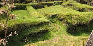
Te Kooti’s generalship was mixed. He could hit and run with the best of them but he flunked set-piece, fixed-defence actions such as Te Pōrere. In an ineptly executed piece of cultural shoplifting, Te Kooti or an ally (it is not clear who) built this British-style redoubt/pā on the bleak pumice lands at the western edge of the Rotoaira basin. It was about 20 m square, had flanking angles (bastions) at the opposing corners and stood apart from a maze of trenches and rifle pits. But Te Pōrere was a bad clone. The angles were poorly sited and the horizontal loopholes prevented the defenders from firing down into the ditch, which the government forces speedily occupied after taking out two small detached positions. On 4 October 1869, at the cost of four dead and four wounded, Lieutenant-Colonel Thomas McDonnell's forces, Ngāti Kahungunu and Arawa as well as Europeans, killed 37 and captured nearly 30. Te Kooti got one thing right, though. The bush next to the pā provided good cover for his flight, wounded, with other survivors. Heriage New Zealand has administered Te Pōrere for more than half a century. Its ‘restoration’ of the fort may not have met modern conservation practice, but that does not detract from the importance of the site of the last major battle of the New Zealand Wars.
This sight of this impressive new railway viaduct well justifies the walk along the line (45 mins) from the Ohakune Station.
An alternative and more scenic route to the viaduct is along the Old Coach Road.
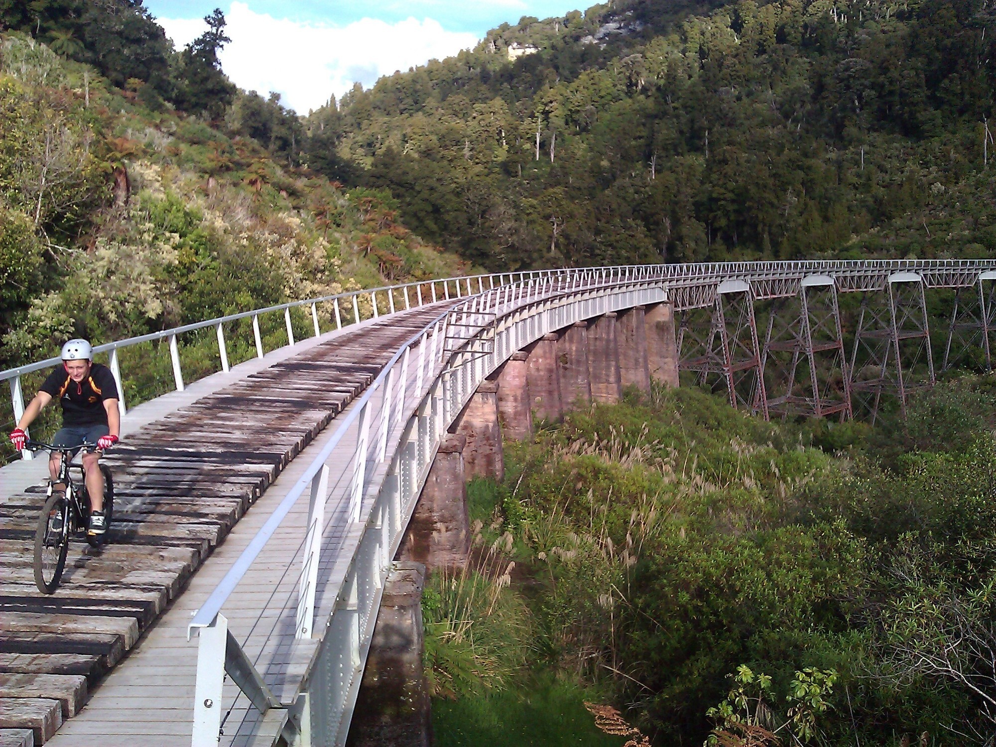
The new Hapuawhenua viaduct was built not only to improve alignment but because concerns existed about the remaining fatigue life of the old curved viaduct, the view of which is equally impressive. The new structure combines reinforced and prestressed concrete. It is a ‘state of the art’ design, which takes advantage of improved understanding of the behaviour of structures under extreme conditions; especially those of a major earthquake. It is 51 m high and 414 m long.
The replaced structure was used as a jumping point in the early days of Bungy jumping. Nearby you will find the disused Hapuawhenua
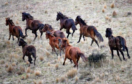
Wild horses were first recorded in the area in 1876.
Kaimanawa wild horses are not a genetically unique population. They have roughly the same genetic makeup as domesticated horses, although they are of mixed breed with diverse genetic influences. They have most in common with the Thoroughbred and Station Hack breeds.
Prior to 1981 there was no official monitoring of horse numbers, movements or range, or any formal management. It was believed there were plenty of wild horses.
Land development, increased competition with human activities, and hunting drove down the number of wild horses. By 1980 they were limited to the southern Kaimanawa area where only about 174 wild horses remained.
New Zealanders were concerned these horses would be lost, so in 1981 a protected area for "horses known as the Kaimanawa Wild Horses" was established. But once protected, the horse population surged – threatening the area's fragile ecology and the horses themselves.
In consultation with all stakeholders, a plan was prepared. Horse numbers are now managed in accordance with the approved plan which includes operations such as annual counts, musters and rehoming of surplus horses.
Often described as New Zealand's greatest day walk, the Tongariro Alpine Crossing is a challenging journey across a remarkable volcanic landscape.
You can walk the track in either direction, but the more popular option begins at Mangatepopo Valley.
Beginning at Mangatepopo Valley near Whakapapa, the track follows a stream and the edges of old lava flows towards the valley head. Look out for varying patches of vegetation that reveal the age of the surrounding lava rock.
At the head of the valley, the trail becomes steeper, climbing from the valley to Mangatepopo Saddle between the mountains of Ngauruhoe and Tongariro. Stunning panoramic views look out over the volcanic terrain. On a clear day, you can see as far as Mount Taranaki.
The trail leads from South Crater upwards towards Red Crater, the highest point of the Tongariro Alpine Crossing. The smell of sulphur is a reminder that this crater is still active.
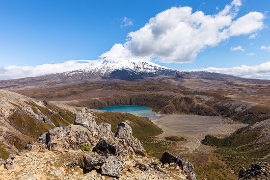
From here you begin the descent, past the stunning Emerald Lakes. This is the highlight of the track and a great place to pause for photos.
The brilliant colour that gives them their name is caused by minerals leaching from the surrounding thermal environment.
The trail continues over Central Crater to the old volcanic vent of Blue Lake, before it rounds the flanks of North Crater and descends to Ketetahi Road end. The final section is a long descent through tussock slopes to cool green forest, a refreshing change to the volcanic landscape.