Whangarei
17.89°C

Whangarei
17.89°C
Waitakere City
16.98°C
Manukau City
17.11°C

Papakura
24.46°C
Hauraki
17.26°C

Waikato
17.67°C
Matamata
18.46°C
Hamilton
17.51°C
Otorohanga
18.52°C
Rotorua
16.6°C
Taupo
15.44°C
Tauranga
19.27°C
Kawerau
18.6°C
Whakatane
19.64°C
Gisborne
15.51°C
New Plymouth
16.98°C

Stratford
8.97°C
Ruapehu
14°C
Wanganui
17°C
Palmerston North
16.41°C
Wairoa
19.19°C
Hastings
18.84°C
Napier
18.49°C
Masterton
15.49°C
Carterton
15.66°C
Porirua
15.99°C
Lower Hutt
16.45°C

Wellington
15.79°C

Tasman
9.35°C
Nelson
16.27°C
Marlborough
3.22°C
Kaikoura
15.48°C
Christchurch
12.59°C
Ashburton
12.52°C
Timaru
13.37°C
Waitaki
11.32°C
Waimate
13.08°C

Queenstown
12.38°C
Dunedin
14.33°C
Southland
9.98°C
Gore
11.31°C
Invercargill
12.06°C
Blenheim
14.73°C
Te Anau
27.35°C
Wanaka
11.17°C
Kaikoura
13.38°C
Stratford
13.54°C
Upper Hutt
15.9°C
About


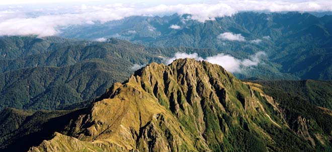
The highest peak in the rugged Raukumara Range, and the highest non-volcanic mountain in the North Island, Maunga Hikurangi (1,754 metres) is recognised as the first point on the New Zealand mainland to greet the morning sun.
The mountain is sacred to the local Ngāti Porou people.
Māori legend from this region suggests that when the demigod Māui fished up the North Island of New Zealand, Mount Hikurangi was the first point to emerge from the sea.
The mountain is also said to be the resting place of the waka (canoe) Nukutaimemeha, which Māui used on that famous fishing trip.
One thousand metres above sea level and two thirds of the way up the mountain stands nine whakairo (Māori carvings) depicting Māui and his whānau (family).
The centrepiece represents Māui himself, while the other eight carvings are positioned to mark the points of the traditional compass. Created to celebrate the new millennium, the whakairo stand as a tribute to the cultural heritage of Ngāti Porou, and as a legacy for future generations.
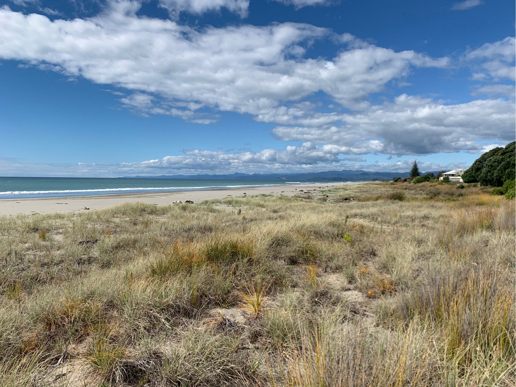
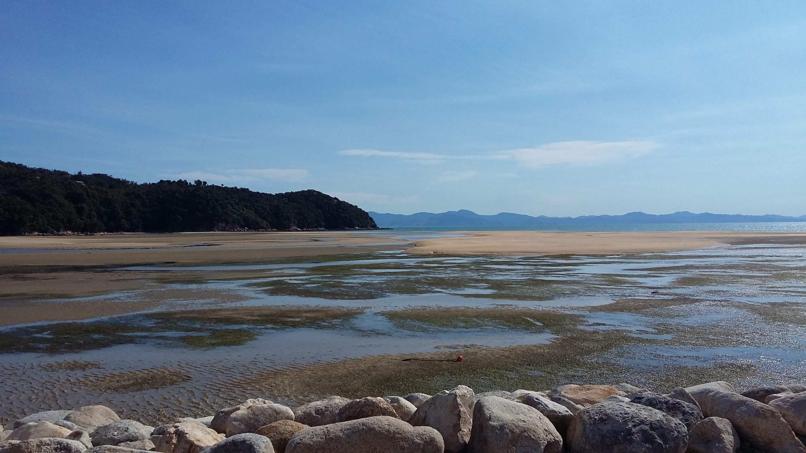
Waiotahi Beach is popular during the summer months attracting swimmers, surfers and anglers who use the beach and nearby river mouths year round. The beach changes a great deal between high and low tide and is much safer for swimmers during the high tide when the rips aren't as strong. All beach users need to be careful as it has many natural hazards. Swimmers are advised to stay between the flags and ask Lifeguards for advice.
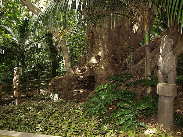
The Hukutaia Domain ranks as one of Opotiki's main attractions.
It is a 5 hectare remnant of extensive native forest that was set aside as a reserve by one of the original owners Mr E.M. Hutchinson in the early 1900's.
Mr Norman Potts was instrumental in developing the reserve with walking tracks and touring all over New Zealand (plus outlying islands) gathering rare and endangered plants some of which now form a very valuable botanical collection. Mr Mark Heginbotham followed on with My Potts work.
Of particular interest is the estimated 2000 to 2500 year old giant Puriri tree. Being hollow the tree was used as a resting place for the bones of Distinguished Dead of the Upokorehe Iwi (Tribe). The tree named Taketakerau was highly tapu (Sacred). Local resident Marnie Anstis has written a book entitled The Millennium Tree which is based on the life of Taketakerau.
The Domain is owned by the Opotiki District Council. A care group looks after the Domain by way of maintenance, pest control and development with generous help from the Council and Environment Bay of Plenty.
Brochures, information sheets and notices about various topics are available in the Domain. There is no charge to visit the Domain.
To get to the Domain on leaving Opotiki township turn left immediately after crossing the Waioeka Bridge (heading west) on to Woodlands Road and drive 7km to very near the end where you will find the Domain sign.
Pick your preferred landscape: sand dunes, forest and farmland, or complete forested wilderness; or all three! Then hire a bike and be on your way on these renowned bike trails in Eastland in the North Island of New Zealand. The Motu Trails are your best chance of seeing the best scenery on the Eastland and Bay of Plenty boundary.
On the Dunes Trail, you have an easy-breezy ride ahead as you worm your way around and over sand dunes. The Motu Road Trail is a historic road nestled in native bush and farmland, with a few downhill sections to enjoy. Then finally there is the adventurous Pakihi Track which is a true backcountry experience.
Whichever trail you decide to do, there is shuttle transport services and bike hire to accommodate. Where most people start the trails from Opotiki, where there is bike hire, shuttle and accommodation, there are some shuttle services that can do pickups from Whakatane, Rotorua and Gisborne.
If you are doing all the trails (91km/56.5 miles) and taking a couple of days to do them, remember to book accommodation or be prepared with a sleeping bag and food if staying the Pakhiri Hut overnight.
Time: 2-3 hours return
Distance: 22km (14 miles) return
Grade: 2 (easy)
As you probably guessed from the name, the Dunes Trail winds up and down the tussock-covered sand dunes between Opotiki and Omarumutu. Don’t worry, riding over sand is not as much of a nightmare as it may sound, as the track is well surfaced, especially with the “sand bridge” giving you a smooth ride surrounded on the beach section.
Be prepared to face some oncoming bikers along the trail in summer. Nevertheless, it’s a good atmosphere on the trail in this busy season. In the off-peak season, you are more likely to just share the trail with the occasional weka, a flightless brown bird.
Although you can access the Dunes Trail at many points along the way, the official start of this easy trail is from the Memorial Park at the northern end of Opotiki, where there’s a car park, drinking fountain and toilets to get ready before the ride!
Begin by crossing the Pakowhai ki Otutaopuku bridge over the Otara River. This is where some of New Zealand’s early settlers arrived in the early-1400s. The trail is wide and gravelled for the first 3km (1.9 miles) until you hit Hikuwai Beach. On a clear day, you will be able to see Whale Island and White Island. You may even see the steam coming from the active volcano.
The next point of interest on the Dunes Trail is the two 6m/20ft-high pou (poles) which face east and west to watch the rising and setting sun. The sand bridge comes next, then afterwards there is the Tirohanga service station if you need an emergency ice cream.
The final 4km (2.5 miles) of the journey is taking twists and turns through the sand dunes. If you are returning to Opotiki, return from the 9km point where you reach the squeeze gate, just so you see the pretty stuff. Otherwise, continue on the roadside where you’ll meet up with the Motu Road Trail, or onto Omarumutu.
Time: 6 hours
Distance: 67km (42 miles) oneway
Grade: 3 (intermediate)
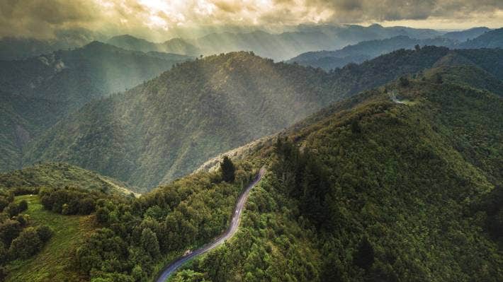
The Motu Road was a road first driven on in 1915 but was closed early on when it was outdated by the state highway. Today, the road is not left to waste, with cyclists making the most of it as the Motu Road Trail. The road has also been used for rally driving, especially as a key stage in the Rally of New Zealand. There are some awesome descents on the trail to at least make you feel a bit like a rally driver.
The easiest direction to go is from Matawai, which is at an altitude of 550 metres (1,804 feet) and go downhill towards the coast. The Motu Road Trail ends where the Dunes Trail begins. The bike trail mostly consists of beautiful bush surroundings and farmland.
The first section of the Motu Road Trail is 14km (8.7 miles) between Matawai and Motu a slight downhill ride on a sealed road. From Motu, it’s worth making the time for a 5km (3 miles) side trip to Motu Falls where you can watch the crashing water from a high swingbridge. Back on the Motu Road Trail, there is a gradual 3km (1.9 miles) climb to great views before getting back to more downhill riding. You can take a quick detour to the Pakihi Track to use the toilet facilities (or continue your ride onto the advanced level Pakihi Track).
Back on the trail, you then make your way to Toatoa, then a sharp 1km climb to the summit of Meremere Hill. You are rewarded with a fun descent dropping 350 metres (1,148 feet) through forest. The final leg of the journey is some small uphill and downhill sections before flattening out onto a sealed road at Waiaua. The track ends and connects with the Dunes Trail.
Time: 2-4 hours
Distance: 21km (13 miles) oneway
Grade: 4 (advanced)
True wilderness lies on the Pakihi Track. This is one for the adventurous! The track was first constructed more than a century ago as a proposed stock route but is now known as one of the top backcountry bike trails in New Zealand. The track is well-maintained with 24 wooden bridges and a 34-metre (111.5-foot) swingbridge to make the ride possible.
Although the ride is not too technical, it is classed as an advanced ride because there are steep dropoffs below the track. There could also be slip damage, so if anything seems sketchy, just get walk those sections.
You’ll need shuttle transportation to either take you to Motu Road or the Gisborne/Opotiki boundary line. The latter is almost at an altitude 800 metres (2,625 feet) which means a fun downhill ride for 9km (5.6 miles) before starting the Pakihi Track.
Once you hit the track you’ll be riding through the unspoiled forest with epic views all around. A good way to mark your progress on the track is by counting the bridges to and from the Pakihi Hut. The first 11km (6.8 miles) section before the hut has 12 bridges, and by bridge 6 you are halfway to the hut. Then the next 10km (6.2 miles) crosses of bridges 13 to 25, with bridge 19 being three quarters into the track.
The end of the Pakihi Track joins with an unsealed road for 9km (5.6 miles) then on a sealed road for 12km (7.5 miles) to Opotiki. An interesting route to take is to cross the Otara River bridge onto Otara East Road instead of continuing straight on the Otara Road.
Why miss out on any trails, when you can do them all in a day if you are fast. The 91km journey can be done by starting and ending in Opotiki. The best way around to do it is by starting on the Dunes Trail then connecting with the Motu Road Trail. This involves some steady uphill riding for about 40km (25 miles) before you reach the junction for the Pakihi Track. The Pakihi Track and the final stretch of road will lead you back to Opotiki.
For those who prefer not to rush it, the Motu Trails can be done in two days, by staying inToatoa where there is a farmstay, at Motu in the Motu Community House, or in the Pakihi Hut, where you’ll need a sleeping bag. The hut beds are first-come-first-served.
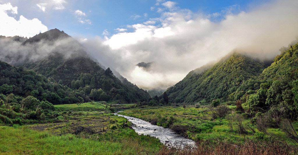
The Waioeka Gorge has spectacular bush and river views and provides excellent opportunities for hunting, tramping, picnics, swimming, canoeing, rafting and fishing.
Situated on State Highway 2 south of Opotiki, Waioeka Gorge Scenic Reserve is a 1800 hectare area of native forest and regenerating farmland. Some of the reserve was cleared for farming after World War 1, but the settlers couldn’t produce enough from the land to make their efforts worthwhile. They left behind them the Tauranga and Manganuku Bridges - the Tauranga Bridge is one of only two harp suspension bridges in the country.
The highway hugs the edge of the Waioeka River, running through the reserve for 50 kilometres. There are numerous reserve entry points, picnic areas and viewing places. Recommended walking tracks include the Tauranga Track (3 hours), Mangapumarumaru Track (4 hours) or Manganuku Track (4 hours). There is an excellent camping ground at the Manganuku Stream and good stretches of open water within the gorge for trout fishing.