Whangarei
17.89°C

Whangarei
17.89°C
Waitakere City
16.98°C
Manukau City
17.11°C

Papakura
24.46°C
Hauraki
17.26°C

Waikato
17.67°C
Matamata
18.46°C
Hamilton
17.51°C
Otorohanga
18.52°C
Rotorua
16.6°C
Taupo
15.44°C
Tauranga
19.27°C
Kawerau
18.6°C
Whakatane
19.64°C
Gisborne
15.51°C
New Plymouth
16.98°C

Stratford
8.97°C
Ruapehu
14°C
Wanganui
17°C
Palmerston North
16.41°C
Wairoa
19.19°C
Hastings
18.84°C
Napier
18.49°C
Masterton
15.49°C
Carterton
15.66°C
Porirua
15.99°C
Lower Hutt
16.45°C

Wellington
15.79°C

Tasman
9.35°C
Nelson
16.27°C
Marlborough
3.22°C
Kaikoura
15.48°C
Christchurch
12.59°C
Ashburton
12.52°C
Timaru
13.37°C
Waitaki
11.32°C
Waimate
13.08°C

Queenstown
12.38°C
Dunedin
14.33°C
Southland
9.98°C
Gore
11.31°C
Invercargill
12.06°C
Blenheim
14.73°C
Te Anau
27.35°C
Wanaka
11.17°C
Kaikoura
13.38°C
Stratford
13.54°C
Upper Hutt
15.9°C
About


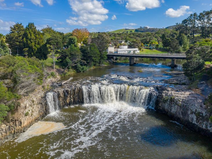
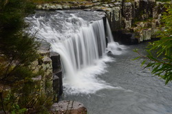
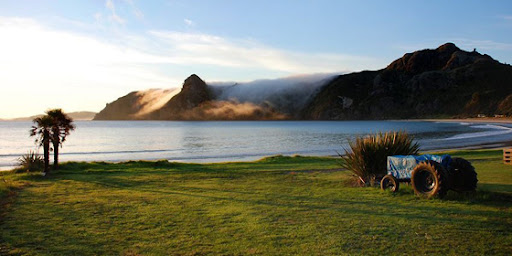
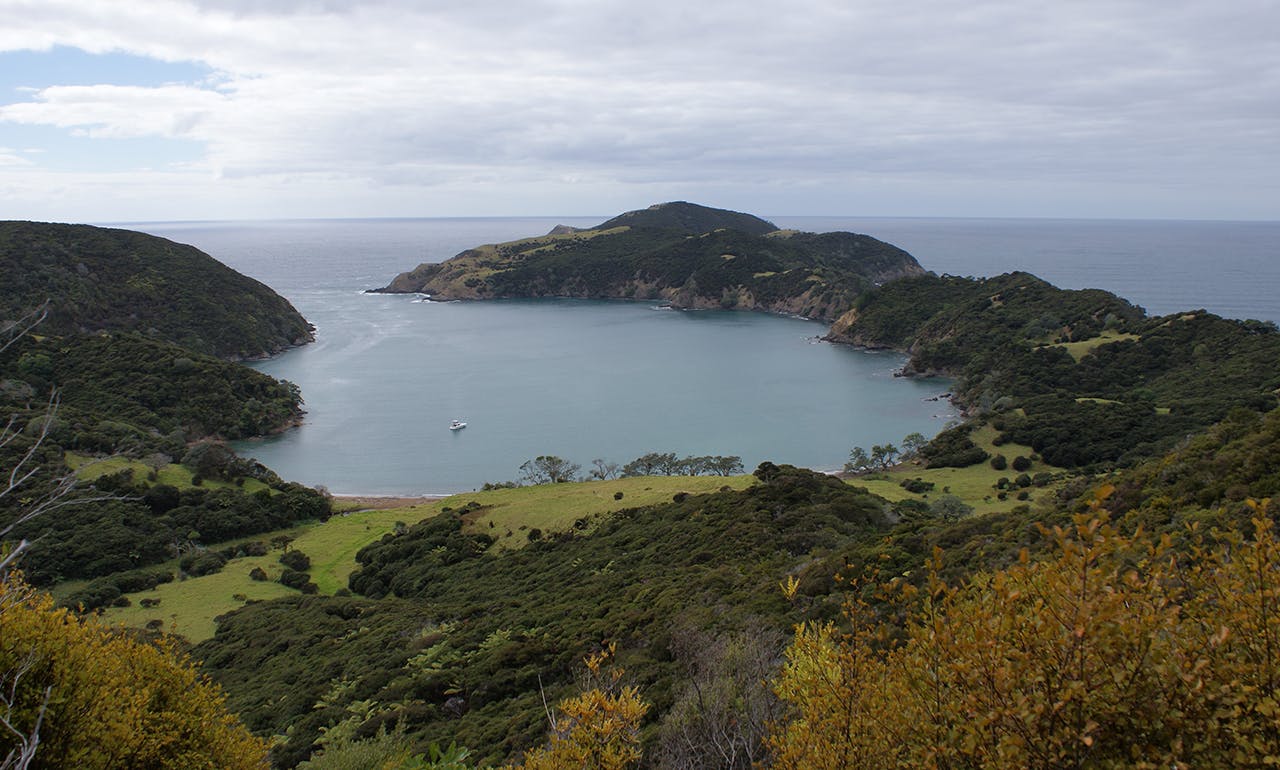
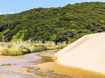
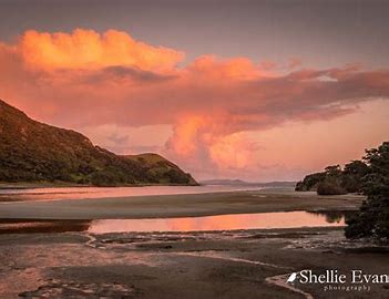
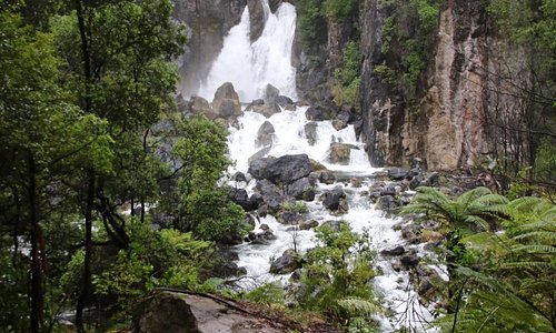
Haruru Falls are located in the beautiful Bay Of Islands in New Zealand's Northland region the water fall is easily reachable and only a few minutes walk from the Haruru Falls carpark, the waterfall is a block type waterfall which is around 5meters high but has a wide drop area.
This waterfall is at the very end of the Waitangi River and drops into a tidal estuary during the warm summer months the flow is moderate but visit this waterfall during the heavy rain in winter and there is a huge amount of water flowing over the drop.
The Haruru Falls are close to the Historic Waitangi Treaty Grounds in the Bay Of Islands, from the falls track there is a walkway that follows the tidal estuary all the way to the Waitangi Treaty grounds this walk is easy and suitable for all the family the walk takes around 1.5 hours return or have someone pick you up at the other end.
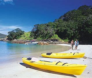
Below the Haruru Falls there is a camping ground and resort accommodation and there are many activities available here, kayaks can be hired here and you can enjoy a great trip down the estuary to Waitangi or you can take an organized tour of Pahia and the Bay Of Islands.
Haruru Falls have some history attached, in the early days of New Zealand the large tidal basin that formed below the Haruru Falls were one of New Zealand's first river ports and a major trading place for Maori the canoes and trading boats would enter the esturay on the incoming tide as the falls are around three kms from the ocean.
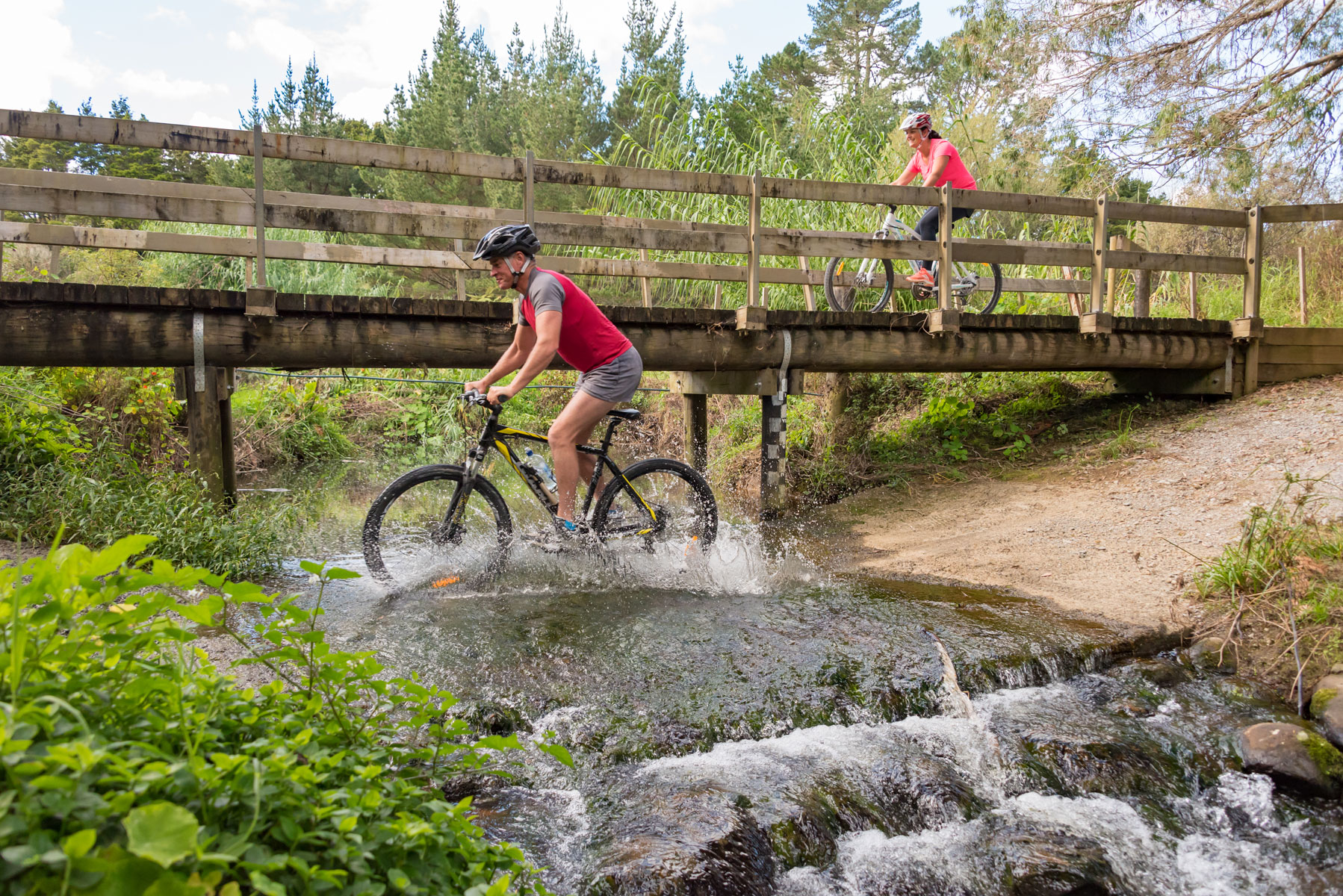
Duration – 2 days, Grade – 1 – 3, Distance – 87km, Highest point – 320m – Kaikohe Hill
Pou Herenga Tai – Twin Coast Cycle Trail travels from the famously beautiful Bay of Islands to the remote and picturesque Hokianga Harbour, or vice versa. Due to its sub-tropical climate – it can be ridden all year round – hence the name “winterless north”.
The trail is 87 km and is divided into four sections and can be ridden in either direction. The central point is Kaikoke and from there the trail descends to the East and the West coasts. This trail goes through diverse and stunning scenery with spectacular views, but it also takes you on a fascinating journey through some of New Zealand’s earliest Maori and European settlements. Story boards along the way bring to life the history and stories of the local people. Visit the Far North to discover the birthplace of the nation.
Cyclists have the choice of staying in Kaikohe or Okaihau as central points and cycle to each coast. From each end a return shuttle can be organised. Others prefer to cycle the full length of the trail starting from Opua and finishing in Horeke. Some cycle both ways. There are those that spread the sections over a few days whilst on holiday in the north.
The bike ride is suitable for most riders as it is generally flat with gentle climbs – most of it being grade 1 and 2, with the Okaihau to Horeke section a grade 2-3. The surface is fairly good and can be ridden all year round, the surface may be a bit rougher if there has been a flooding event. Please report these via the website so contractors can be engaged to maintain the cycle trail. You will find most of the trail is off road, and you can cycle two abreast. There is some on road cycling but these are quiet country roads.
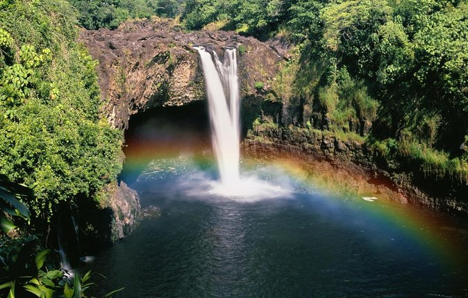
This short, easy walk suitable for buggies, leads to the stunning Rainbow Falls on the Kerikeri River.
This short walk, starting at the Rainbow Falls carpark, is accessible by wheelchair.
Three stunning viewing platforms are at the top of the Rainbow Falls.
The Te Araroa Trail joins the Kerikeri River Track at this point and carries on down the hill towards the Kerikeri Basin.
You can stroll along the riverbank to the spectacular Rainbow Falls, where the water tumbles into a popular swimming hole surrounded by native bush. The falls are also a popular destination for kayakers to explore.
There are parking and picnicking areas at the end of Rainbow Falls Road.
Russell, known as Kororareka, in the early 19th century, was the first permanent European settlement and seaport in New Zealand. Before the arrival of the Europeans, Russell was inhabited by Māori because of its salubrious climate and the abundance of food, fish and fertile soil.
When European and American ships began visiting New Zealand in the early 1800s, the indigenous Maori quickly recognised there were great advantages in trading with these strangers, whom they called tauiwi.The Bay of Islands offered a safe anchorage and had a large Māori population. To attract ships, Māori began to supply food and timber. What the Māori population wanted was respect, plus firearms, alcohol, and other goods of European manufacture.
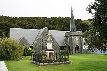
There are an abundance of things to do and see here. The Christ Church is top on the list as this is the oldest church in the north, and still has bullet holes fromthe early settlement days.
Built some time in the 1880's, this church boast magnificent gothic architecture, as well as stunning stained glass windows and interesting stories surrounding the graves in the graveyard nearby.
With Sunday mass held every Sunday at 5:30pm, you are more than welcome to join. Some of the original families that settled here are still attending this church, and tell stories handed down from generation to generation.
With stands providing information about the area, who is buried here and what happened around the church, you will not be dissapointed.
Exquisite waterfall, Wharepoke Falls, also known as Wharepuke Falls, is found on the Kerikeri River. Sadly, it’s quite often overlooked due to an extremely popular neighbor – Rainbow Falls. Really worth to visit!
In Kerikeri cross the Kerikeri River via Heritage Bypass and turn right into Waipapa Rd. On the first round-about turn right into Landing Rd (follow signs ‘Historic Stone Store’) and follow it for 600m until you reach a huge car park, which has toilets and fantastic picnic area with the view of the Kerikeri River.
From the parking follow an easy Kerikeri Walkway for 20 minutes until you see the waterfall. You won’t miss it. Superb spots for taking beautiful photos are available here.
Return via the same track, or follow 3-hours’ return Kerikeri River Track (Kerikeri Walkway is a part of this track) which brings you to the Rainbow Falls.
Walk in the footsteps of chief Hongi Hika and early missionaries to Kororipo Pā – this short, easy walk is suitable for children.
Walk through the Waharoa (carved red entrance way) up a gentle grass slope featuring gum trees and regenerating native forest. Wayfinding markers will guide you to Kororipo Pā (fortified Maori settlement) where there is a viewing platform with amazing views.
The return walk is 5-minute stroll down a gentle slope. Keep right to join the historic route to the Stone Store. The track winds through regenerating native forest, crosses a small bridge and finishes on Kerikeri Road opposite the historic Stone Store.
The walk is 4 km from Kerikeri. Follow Kerikeri Road, turn left into Heritage Bypass, right into Waipapa Road, then right into Landing Road. Kororipo Heritage Park is at the end of the road, next to to the Kerikeri River.
Park in the northern carpark off Landing Road. Start with a leisurely stroll across the pedestrian river bridge and turn right up the service lane onto Kerikeri Road. For disabled access, drive to 246 Kerikeri Road in front of the Stone Store. There are two parks available for people with wheelchairs.
Kororipo Heritage Park has toilets, a café, restaurant, picnic tables and a BBQ area.
Combine your walk with a visit to the Stone Store – New Zealand’s oldest stone building, a guided tour of the former mission house. Or visit Te Ahurea, a replica pre-European Māori fishing (kainga) village named after Ngāpuhi chief Rewa.
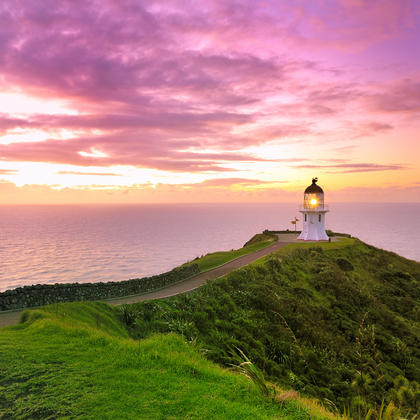
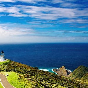
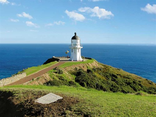
At the Cape, the Tasman Sea meets the Pacific Ocean in a spectacular swirl of currents. At the northernmost tip of the Cape is a gnarled pohutukawa tree, believed to be over 800 years old. According to Maori oral history, the spirits of deceased Maori leap from this tree into the ocean to return to their ancestral homeland of Hawaiki.
While it’s not quite the most northern point of New Zealand (North Cape is further north, but it’s a scientific reserve and not open to the public), Cape Reinga is definitely the end of the road.
From Kaitaia, the drive to Cape Reinga takes about 1.5 hours each way. Guided coach tours depart from Kaitaia and Paihia (Bay of Islands) daily. As well as taking you up to the Cape, these trips travel along popular 90 Mile Beach, bringing Maori and early European history to life on the way.
For those short on time, scenic flights depart from the Bay of Islands, flying to the Cape and along both coasts of New Zealand.
Being a sacred site, eating is not permitted at Cape Reinga. However if you're looking for a good picnic spot, take the turn off to beautiful Tapotupotu Bay, 5km before the Cape.
Ninety-Mile Beach is the fabled strip of sand that stretches from Ahipara to Scott Point, five kilometres south of Cape Maria van Diemen. Truth be told, it is actually 88 kilometres long.
This beach is officially a highway, but is really only suitable for 4WD vehicles and is safe to drive only at specific times of the tides. Rental companies won’t allow their cars on the sand, mostly for safety reasons. The easy way to drive along the beach is to catch a coach tour from Kaitaia. If you are short of time in Northland and staying in the Bay of Islands, coach tours and scenic flights up to Cape Reinga depart from Paihia daily. Beach activities range from surfcasting and swimming to bodyboarding down the sand dunes. A special treat is digging for tuatua (a native shellfish) in the sand at low tide. Flanking the beach is the Aupouri Forest, which provides a green escape from the hot sun.
Once a year in late February or early March, 90 Mile Beach hosts a five day fishing competition. Hundreds of anglers surf cast from the beach hoping to catch the biggest snapper, a delicious white-flesh fish found in New Zealand waters.
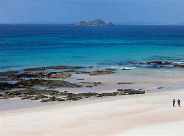
Karikari Peninsula is renowned for its amazing white sandy beaches and bays such as popular Maitai Bay. Other attractions include historical Puwheke Beach, Karikari Beach and picturesque Waikato Bay.
The Karikari Peninsula was a favoured area for seasonal hunting and gathering activities by pre-European Māori. Numerous midden are located in the adjacent fore dunes, showing a heavy reliance on marine resources for a long period of time with a focus on seasonal camping.
At Lake Ohia, the former lake bed offers snapshots of the recent past and ancient history showing visible effects of gum-digging and featuring ancient remains of a once thriving kauri forest.
Karikari is the traditional homeland for the Ngati Kahu tribe. In Maori mythology, the waka (canoe) Waipapa, captained by Kaiwhetu and Wairere, made its first landing in New Zealand at Karikari.
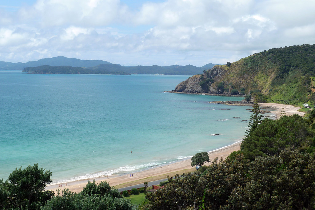
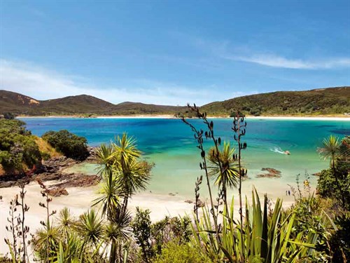
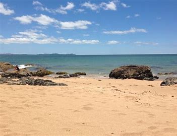
Doubtless Bay, Northland New Zealand. Beaches of luxurious caramel and white sands invite you to swim, snorkel, fish and sail.
In 1769 Captain James Cook looked in on this expanse of water and declared it was "doubtless a bay". He then continued his circumnavigation of New Zealand. Within days another explorer, Jean-François-Marie de Surville, anchored on the western side of the bay for a number of weeks. He named the bay 'La Baie de Lauriston', in honour of Lauriston, Governor of French India.
Captain Cook's rather haphazard naming of the bay stuck. Today, Doubtless Bay is without doubt a magnificent place for a holiday. Beach after beach of luxurious caramel and white sands invite you to swim, snorkel, fish and sail.
There are several small settlements within the bay, stretching in a horseshoe from Coopers Beach at the south end to Whatuwhiwhi in the north. You can also drive over the Karikari Peninsula to Maitai Bay and Rangiputa. Mangonui is the main town for this area - it has some wonderful historic buildings that you can discover by walking the heritage trail.
Kauri milling and ship building are long established industries and one of the last kauri sawmills and shipyards, operated by Lanes & Sons for over a century, can be seen at Totara North.
The ‘Rainbow Warrior’ lies at rest off Matauri Bay with a memorial on a nearby pa.
Taupo Bay lies just north of the entrance to the Whangaroa Harbour.
To reach this idyllic beach by road, one must travel 11km to the north of Whangaroa Harbour and then turn eastwards for a similar distance, but the journey is well worth it. This picturesque white sandy beach is the ideal surfing and family holiday destination. Taupo Bay offers quality beach front accommodation, and there is also a camping ground near the beach. Small old-style baches and newer holiday homes line the beachfront. The beach provides an easy launching ramp for trailer boats. Taupo Bay is in a spectacularly scenic setting, surrounded by native bush.
Taupo Bay is one of Northland's best beaches. The beach is extremely wide and slopes gradually into the sea and curves in a gentle arc for a length of almost one and a half kilometres. Taupo Bay is renowned for its surf. The Isobar Surf School is found here and teaches the sport to all comers.
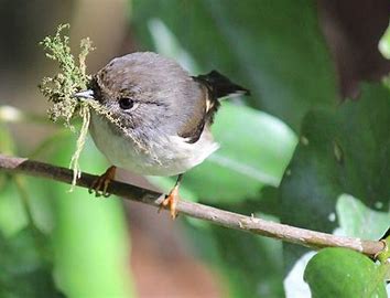
The 1700 hectare Pukenui/Western Hills Forest is located on the doorstep of Whangarei City. Numerous tracks link Whangarei District Council and Department of Conservation administered land which includes the Coronation Scenic Reserve, Pukenui Conservation Park, Whau Valley Water Supply Reserve and Whangarei Quarry Gardens Recreation Reserve. Walks range from 30 minutes return (Rust Track) to 8 hours (Amalin Drive to Russell Road) showcasing a beautiful array of native vegetation with some impressive mature trees, picturesque streams and a variety of forest birds.
The forest complex is steeped in history with Maori pa sites and storage pits, a deserted goldmine and remnants of former logging operations to be seen. Several places worth visiting, found at the start of the tracks, are the Quarry Craft Centre (off Selwyn Avenue) and the Whangarei Quarry Gardens (off Russell Road).
Please keep to the tracks marked with orange triangle markers and respect private property. No dogs, camping, fires or bikes are permitted and remember to take only photos and leave only footprints.
The first section of this track is an easy walk, suitable for all ages. To complete the full loop, a moderate level of fitness is recommended.
Time: 3 - 4 hrs (from car park)
Distance: 8.2 km (from car park)
From the car park, access to the forest is through open farmland displaying some attractive dry stone walls dating back to World War II. Once over the stile, this walk takes you along the edge of the forest past regenerating native vegetation. Tomtits are often sighted here and the delightful song of the tui can be heard as the track enters the forest. An old forestry bullock track leads you down to the beautiful Mangere Stream where there are some good picnic spots. There are some steep hills to climb which return you to the bullock track and along the fence line to the stile. Large kauri and totara, native orchids, and a range of forest types feature on this track.
This walk is through some of the best native forest in the Bay of Islands. It takes you from Broadview Road, Opua down through a pretty valley to join the Paihia to Opua walkway. The forest here has never been milled or burned.
A feature of the walk is the number of large, old native puriri trees to be seen (vitex lucens). This tree can grow to about 20m in height and has a stout trunk and a spreading canopy of glossy green leaves. It is related to the teak and its very hard, dark red-brown timber was popular with early settlers for railway sleepers, fence posts, house piles and bridges.
It is said to be New Zealand’s strongest wood and was so hard to split that timber workers often resorted to dynamite. Its timber can be spoiled by the puriri moth, a large green moth whose larvae drive holes into the growing wood.
Maori have used infusions of puriri leaves to bathe muscular aches and sprains and as a remedy for sore throats and ulcers.
The Flagstaff Hill Loop Track takes you through regenerating kanuka/manuka scrub down into the Waipara/Watering Bay stream and wetland then back up to one of New Zealand’s most iconic historic sites - Te Maiki/Flagstaff Hill.
On this walk you may very well come across the endangered North Island weka, which has been successfully reintroduced to the Russell Peninsula by the Russell Landcare Trust.
A section of this track crosses private land – walkers are welcome. Respect the signage in place for no dogs, even on a lead, and keep to the formed track.
Walk north from the northern end of The Strand, Kororareka Bay along the beaches to Watering Bay. Turn inland along the Flagstaff Hill Loop Track. Take the left-hand fork in the track and climb through regenerating coastal forest to reach Titore Way. Turn right onto the road, walk 300 metres along this road to a sign marking the final leg of the Flagstaff Hill Loop Track. This leg takes you up through regenerating coastal scrub to the famous flagstaff, 360-degree views of the Bay of Islands and the Flagstaff Hill summit (Te Maiki).
Once at the summit, take the path down to the carpark. At the carpark, there are two options: cross the carpark and take the short track up to the sundial for more stunning views of the Bay of Islands and Russell township or turn right to continue the Flagstaff Hill Loop Track down to the top of Wellington Street and from there to Russell township.
The Flagstaff Hill Loop Track starts at the intersection of Wellington and Kent Streets, near the boatramp on The Strand in Russell. Walk approximately 300 metres up Wellington Street - look out for a sign on your left. This high tide alternative track takes you down into the Kororareka Reserve. At the intersection of the tracks in the valley turn right and follow the Flagstaff Hill Loop Track to Titore Way. See the low tide description for further route directions from here.
Note: Wellington Street is very narrow. If you are walking, watch out for vehicles; if you are driving look out for pedestrians.
Come for a walk along a path that whalers used to take in the early 20th century to one of New Zealand’s last remaining shore-based whaling stations.
This track is a comfortable walk starting at the Tangatapu wetlands through regenerating coastal forest up and over a ridge to the sandy beach at the head of the Whangamumu Harbour. Interpretation signs explain the historic features of the area. The track is not suitable for mountain biking.
Once at Whangamumu Harbour turn left along the beach and take the short 10-minute track to the historic Whangamumu Whaling Station. This track can be walked up 1-2 hours either side of high tide; at other tide times this short section of beach track is closed to walkers.
Access to the Whangamumu Track is from Rawhiti Road, 1.1 km from the Manawaora Road and Rawhiti Road intersection.
From Russell, take the Russell-Whakapara Road for 13.8 km and turning off at Kempthorne Road. Follow the road through Parekura Bay, continuing on to Manawaora Road. At the top of the road, turn left onto Rawhiti Road.
From Whangarei travel north turning off SH1 at Whakapara. Follow the Russell Road until you get to Rawhiti Road. The harbour was where one of New Zealand’s last shore-based whaling stations existed: the historic Whangamumu Whaling Station.
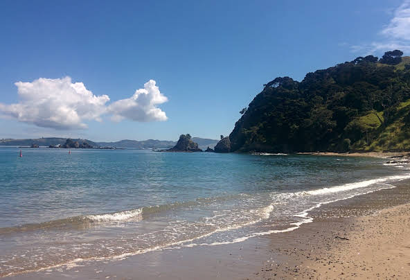
Just a 2 minute drive or short walk from the main town is one of the most amazing beaches in all of the Bay of Islands! Oneroa Bay in Russell takes you from an English Colonial town to a tropical ocean setting.
This is where you can pull up a beach chair and spend the whole afternoon. Unlike the town beach where the water is calm, Oneroa Bay in Russell has the perfect waves for swimming and boogie boarding. Try and spend plenty of time here on your trip to Russell!
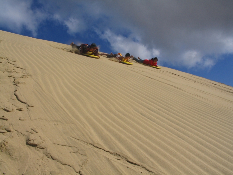
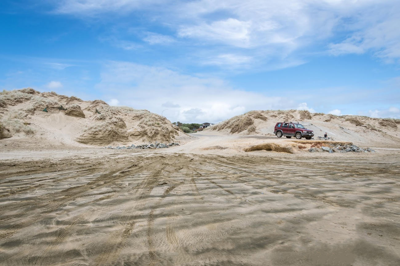
Just a short drive off the main road north to Cape Rēinga, they are a small detour that delivers a big reward.
Te Paki Sand Dunes, also called the Giant Sand Dunes, are a collection of sand dunes located on the Northland Peninsula of New Zealand. The dunes abut the Ninety Mile Beach and are a popular spot for sandboarding.
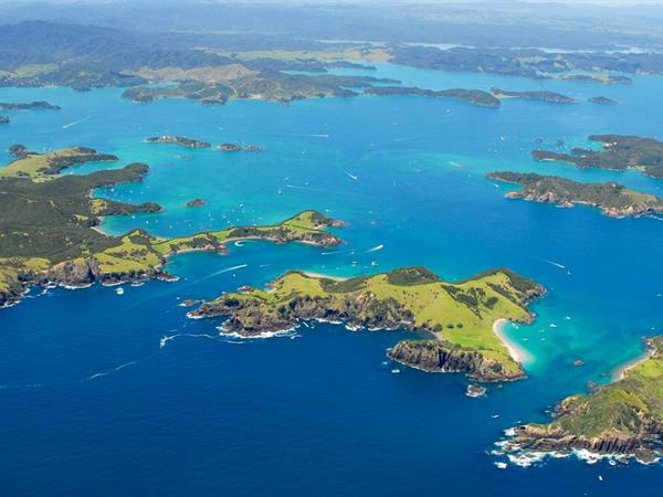
If the weather is kind, take a ferry from Paihia or Russell to Urupukapuka Island, a pest-free paradise for our feathered friends. A five-hour walk takes in the whole island and there are kayaks for hire if you fancy a paddle. The café at Ōtehei Bay is open all year (though just weekends in winter) for a well-deserved refuel
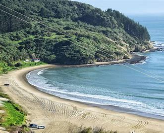
The Maitai Bay is lined with a crescent shaped sandy beach lined by pohutukawa trees overlooking the Pacific Ocean. Popular activities include swimming, boating diving, fishing, exploring the walking trails and camping. Facilities at the Maitai Bay campground include tap water, toilets and cold showers. Fires, fire works and domestic animals are not permitted on the beach or campground
Rarawa Beach is a popular summer location and the majority of patrons will stay in the Department of Conservation camping ground that is located at the southern end. Four wheel drives can be driven onto the sand from the central access point and this allows users easy access to the entire beach. Rarawa is good for swimming during the warmer months and is surfed and fished year round. Anyone that is entering the water should check the beach conditions carefully as powerful waves and strong rips are common. Rarawa Beach is safer around the high tide.
Coopers Beach is a 2.5km long beach crescent-shaped beach stretches along Doubtless Bay. Pohutukawa trees line the beach, providing shade and a bit of colour when in bloom. Pohutukawa trees are also known as New Zealand Christmas trees because of their crimson red flowers that bloom around the holidays.
The Taumarumaru Scenic Reserve is a couple of minutes west and many urban conveniences like shopping centers, medical buildings and children's playgrounds are right next to the beach.
This is a short but delightful stroll, partly on the boardwalk through groves of kauri to an elevated lookout platform and bench seat. Once at the lookout you will be surrounded by kauri trees of different ages – from young rickers up to 25 years old to more mature trees of about 400 years in age.
If you want to walk for a further two hours, return to Oromahoe Road, turn right towards SH11 for 800 m and take the Oromahoe Traverse. This track will take you eventually to School Road in Paihia. Along the way, the Oromahoe Traverse joins the Paihia School Road Track.
Once at the Paihia School Road Track you will have stunning views of Waitangi, across Motumairie (one of the islands off Paihia) to Russell then over the Russell Peninsula to Cape Brett and Ipipiri, the eastern Bay of Islands.
A narrow grassy track, steep in places, starts from Du Fresne Place and leads you across a number of what were once defensive ditches to the end of Tapeka Peninsula and the top-most part of Tapeka Pa itself.
You can get stunning views all along the track over the whole of the Bay of Islands, from Cape Wiwiki in the north to Rakaumangamanga in the south-east.
Tapeka Point is a sheltered bay right at the end of the Russell Peninsula. For boaties, there is a boat ramp at the end. This is a great little beach for the young ones with lots of flat sand. There are no waves so very safe. There is a platform they can swim out to for the older kids.
There is a coastal walk and a 360-degree lookout 10 minutes walk from the beach. You can anchor your boat in the Bay, and there are several Tapeka Point Accommodation options too, right on the beachfront.
Tapotupotu Bay is one of New Zealands northern most beaches, located just a few kilometres from Cape Reinga. Tapotupotu Bay has a Department of Conservation camping ground located at its eastern end along side the stream mouth and tidal inlet. Here you will also find the public amenities. If entering the water while at the beach you should stay clear of the headland rocks and also the stream mouth. There is no Lifeguarding Service and the area is hard to access.
This is an easy bush walk through broadleaf and podocarp forest along an old formed roadway. In summer, the lush forest canopy provides cooling shade.
After about 30 minute you come to a junction: A 20-minute return walk up a steep narrow track takes you to a stunning kauri grove. Strewn on the forest floor underneath the kauri are pieces of kauri bark and you can take a moment to study their amazing shapes and patterns. A 15-minute return track takes you to a lookout point over the forest.
You can find the walkway entrance by travelling south from Kaitaia on SH 1 for about 3 km. Turn right onto Larmer Road and follow it to its end. The track is signposted. The exit of the walkway is at Veza Road, off Diggers Valley Road.
The Kaitaia Walkway is a tribute to local ancestors. Dug by hand during the early part of the 20th century, it was originally planned as a road in from Kaitaia to Diggers Valley. The gentle grade, even over the saddle is a tribute to the ability of the early surveyors.
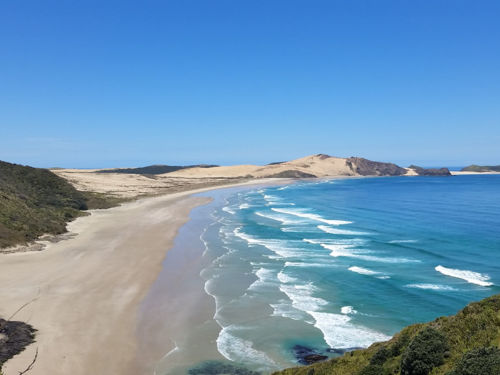
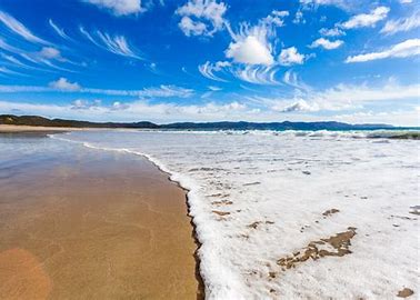
Renowned for spectacular sunsets and boasting one of the best left hand surf breaks in the world, Ninety Mile Beach is an almost never-ending paradise. Ninety-Mile Beach is the fabled strip of sand that stretches from Ahipara to Scott Point, five kilometres south of Cape Maria van Diemen. Truth be told, it is actually 88 kilometres long.
This beach is officially a highway, but is really only suitable for 4WD vehicles and is safe to drive only at specific times of the tides. Rental companies won’t allow their cars on the sand, mostly for safety reasons. The easy way to drive along the beach is to catch a coach tour from Kaitaia If you are short of time in Northland and staying in the Bay of Islands, coach tours and scenic flights up to Cape Reinga depart from Paihia daily.
Shipwreck Bay is one of those spots known by NZ surfers, even if they’ve never ridden there before. Shipwreck Bay’s name is because of the shipwrecks still visible at low tide. Take a short walk from the carpark out to the beach. A great spot for surfers, keen explorers of shipwrecks or just for a picnic and surfer-watching.
The round-trip walk is 16 km in length and takes between 4 hours 30 minutes to 5 hours to complete. The track crosses farmlands and dunes.
This loop track covers a range of landscapes and terrain. You first walk across paddocks for about 15 minutes. Once you step over a stile, you walk through manuka scrub and over sand dunes.
The track provides spectacular views of dunes, headlands and West Coast beaches.
Time: 30 min one way
Distance: 2.5 km
Time: 1 hr 15 min one way
Distance: 4 km
Twilight - Te Werahi Loop Track links up with the Twilight Beach to Te Paki Stream track heading south, the Te Werahi Beach to Twilight Beach track, and the Cape Reinga to Te Werahi Beach track, all of which form part of the Te Paki Coastal Track.
Follow State Highway 1 north. From Te Paki onwards, follow Cape Reinga Road. Cape Reinga Road gets very busy over the summer months. Drive slowly and take extra caution. You can access this track from the Te Werahi Gate car park on SH 1, signposted about 4.5 km south of Cape Reinga.
From the gate, there is a well-graded walk to the coast, which connects with the Te Paki Coastal Track as part of the loop. A dry-weather access across the farm leads to the signpost marking the beginning of the track.
Te Werahi is a large freshwater wetland system, which has three raupō swamps linked by narrow sandy streams. It can be seen from the road to or from Cape Reinga. Te Werahi is an important site for wetland birds such as Australasian bitterns/matuku, grey ducks, grey teals/tētē, New Zealand shovelers/kuruwhengi, pied stilts/poaka, pied shags and little shags.
This is a scenic beach with a nearby lagoon suitable for swimming and kayaking. Visit Cape Reinga/Te Rerenga Wairua only 5 minutes drive away or 3 hours via the walking track. Stay at New Zealand’s most northern campsite and experience the scenic wonders of Tapotupotu, from lush forest to breaking surf and breath-taking views. Camp with the beach at your doorstep, and awaken to the sweet sound of white water breaking on the sand. Tapotupotu is the perfect place to relax, enjoy and explore the great Far North.
There are 7 sq km of giant sand dunes on either side of the mouth of Te Paki Stream. For those wishing to clamber up and toboggan back down, you can rent sandboards from local outfits signposted en route or from a caravan at the car park (during summer only). A large chunk of the land around Cape Reinga is part of the Te Paki Recreation Reserves managed by DOC. It’s public land with free access; leave the gates as you found them and don’t disturb the animals.
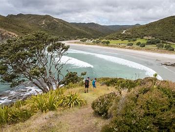
Kapowairua (Spirits Bay) is a place to relax, enjoy and explore the great outdoors. There is a scenic DOC campsite nearby to stay at, with lush forests and sandy beaches in close range. There’s a 3 hour walk along beautiful Spirits Bay that takes you to Pandora where you can stop to observe shore birds or camp for the night.
A stunning white sandy beach right on your doorstep. Rarawa is your own slice of Far North paradise, so come relax and enjoy. At high tide enjoy swimming in the lagoon, or go for a dip in the ocean. Other popular activities include, fishing, kayaking and all types of water activities.
Nestled along the rugged and untouched coastline of New Zealand's Far North, Henderson Bay beckons with its unspoiled beauty and untamed charm. With its golden sands, crystal-clear waters, and backdrop of lush native forests, this hidden coastal gem is a paradise for those seeking a tranquil escape and an authentic connection with nature.
Henderson Bay, a well-kept secret among nature enthusiasts, offers a pristine and remote beach experience. The sweeping crescent of shoreline invites you to stroll along the water's edge, collecting seashells and soaking in the breathtaking panoramic views of the Tasman Sea. Here, the world seems to slow down, allowing you to savor the simplicity of beachcombing and the soothing sound of waves.
For the adventurous at heart, Henderson Bay's pristine waters are ideal for swimming, surfing, and snorkeling. The surrounding landscape also features enchanting walking trails that wind through native bush, providing glimpses of unique wildlife and the chance to experience the wilderness of the Far North.
Henderson Bay in Far North is more than a beach; it's a haven for nature lovers and a serene escape from the demands of daily life. Whether you're a seeker of solitude, an explorer of rugged beauty, or simply looking to unwind in a natural wonderland, Henderson Bay invites you to uncover the untamed spirit of New Zealand's Far North.
Houhora Heads is an easy-to-spot landmark, Mt. Camel (Mt. Houhora) was the first part of New Zealand that the early explorer Kupe saw, but he thought it was a whale, according to Māori legend. The harbour is long and narrow, mostly sheltered but with exposed sand banks at low tide. There is a deep channel along the southern shore as far as Pukenui Wharf. Mt Camel/Tohoraha (also called Mt Houhora) is a 236-metre hill forming the North Head. The South Head is a flat area.
A stunning spot hidden away on the north side of Rangaunu Harbour. You get off the main road north of Waipapakauri and head over to the inner harbour.
East Beach has pure white sand, and is a great fishing spot, nice for a walk and of course swimming.
Waipapakauri beach access is often referred to as “The Ramp” by locals. Popular activities include swimming, surfcasting, surfing, boating, fishing, kite flying, hang gliding, shellfishing and of course walking along the Tasman Sea. This beach is located close to the center of “Ninety Mile Beach”. The world’s biggest snapper surf-casting contest takes place annually at the end of the swimming season, in early March, and is based here.
Ahipara Beach is a safe swimming location and it gets a great deal of use for this purpose during the warmer months. The beach slopes gently into the ocean and waves break evenly all along the beach. Just to the south of the beach there is a good fishing and surfing spot and this gets a great deal of use. All users need to be careful of the northward longshore drift that is present during times of surf.
You would swear you were on a tropical island, turquoise water, white sand and still that unspoilt isolated feeling, you would swear you weren’t in NZ.
Perfect swimming beach, recommended surf casting spot and boat launching facilities there is something for everyone in the family.
Puheke Beach is a glorious surf beach which invites you in for a swim or a paddle. If you walk along the stretch of beach, away from any other swimmers who have chanced upon it, there will nothing ahead of you but the great sweep of the coast, the white sand and the dunes. This idyllic beach offers you a truly blissful retreat.
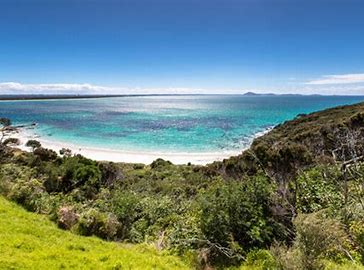
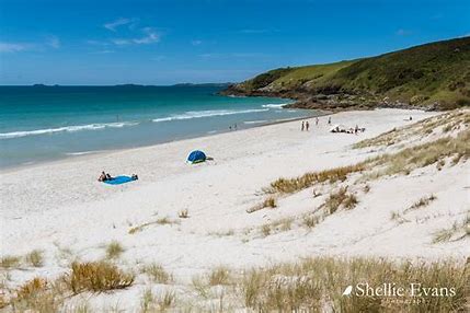
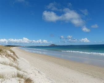
This beach is fantastic in the summertime for swimming, the sand is a stunning pure white silica sand which is typical of alot of beaches on the eastern side of the Far North.
This is a top spot for relaxing, swimming, fishing, walking or whatever! As it is opposite Matai Bay, you can expect the same picturesque scenery and activities as Matai Bay.
The waters surrounding Whatuwhiwhi k are a fishers paradise, offering some of New Zealand’s best game, deep sea and land-based fishing. Most of the world records for striped marlin of varying classes have been established off the tip of the Karikari Peninsula. Boats can be launched here (4WD recommended) and if you are feeling energetic, take a walk along this stretch of coastline and get yourself some Tuatua at low tide.
Whether you head out for a day on the boat or surf cast from the beach or rocks, you’re bound to bring home some fresh fish for dinner!
Tokerau Beach is the longest beach on the Karikari Peninsula, with sand stretching for 18km along Doutbless Bay. The beach is a popular location for swimming, snorkelling, diving, fishing, collecting tuatua, kayaking and boating.
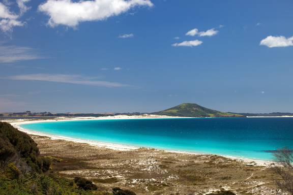
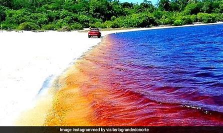
Have you ever fantasised about swimming in a bathtub of Coca Cola? Okay, that’s a bit strange, but on the Karikari Peninsula, you can swim in a whole lake that looks just like coke! The water is turned the red brown colours by the peat and natural tannins in the water, it doesn’t colour your skin, it’s perfectly safe.
Please check the current safety of the water and observe signage that may be erected for your safety. There are times when the lake is not safe to swim in.
A beautiful reflection of one of New Zealand’s Far north beaches. Taipa Beach is white sand with a light shelly base, it is a safe swimming beach with majority of the time small waves, there is also sheltered swing in the Oruru River side. There is plenty of parking and the entire beach is useable. The local shops are 5 mins walk for refreshments, Boat launching, Toilets, cafe, wharf, boating club and seats are all accessible along the beach edge.
Cable Bay, directly off SH10. Cable bay offers you a mixture of Swimming in the ocean or when the tides in at the north end of the beach you’ll find a shelter inlet which is fantastic for the kids. The sand is a mixture of finely crushed shells which gives the sand a slightly pinkish look, the sand is soft to walk on though. It’s not an uncommon sight to see people fishing off the rocks, with great northland fishing results, there is also a variety of rock pools scared along the bay.
Great relaxing views, and fantastic ice cream shop, theres a rest stop with tables, and even a nice playground and grassy verge for the kids to run free.
Hihi, named after the rare and beautiful stitchbird, is a small beach community. It has long been the land bridge first connecting the surrounding Māori pā with the many early settlements and food gathering areas to the north. Later it would join the whaling store on Butler Point and to the farming and logging areas up towards Taemaro Bay, which had its own shore based whaling station in the day. Now this idylic setting makes it perfect for baches, launching small fishing boats, and camping at the campsite.
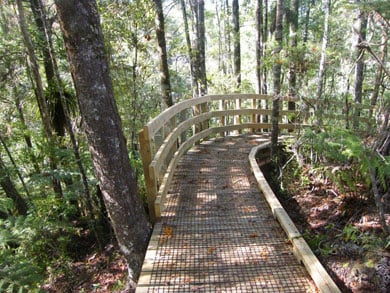
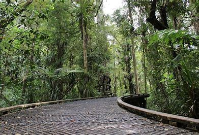
A boardward winds through a mature stand of kauri, swamp forest and associated vegetation. Interpretive panels help you understand and enjoy this special forest ecosystem. A large viewing area set in a kauri grove allows you to sit in awe of the towering trees around you. The track is suitable for all ages and fitness levels.
If travelling south on State Highway 10, Puketi Kauri Forest is signposted 2.4 km south of Kaeo. If driving north on State Highway 10, 1 km north of Waipapa, turn left onto Pungaere Road and follow it for 16 km. At the T-intersection, turn right, follow Waiare Road for about 1 km. There is a carpark on your right; the start of the track is across the road. The walk can also be reached from State Highway 1. Take the Puketi Road turn, then left into Waiare Road. Follow Waiare Road past the Puketi Forest Headquarters on your left. Take care when you leave the state highways as you'll be travelling on unsealed roads.
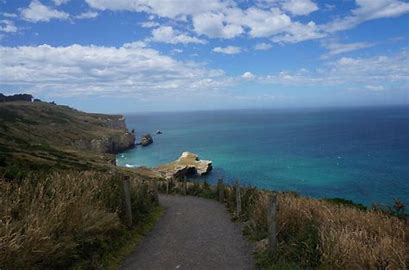
The Cape Brett Track traverses rugged terrain for 16 km through native and regenerating bush. Expect dramatic coastal views; steep cliffs and drop-offs to the side of the track are a feature.
Cape Brett Track traverses through native and regenerating bush. The track runs along the ridge through Maori-owned land before reaching conservation land at Deep Water Cove - Manawahuna for the last 6 km of the track. You can take a side-track (1 hr return) down to Deep Water Cove, where you can enjoy a refreshing swim and snorkel.
Mountain biking is not permitted as the track is unsuitable for this.
From the forested ridges, you can take in spectacular coastal scenery. Towards the Cape, walking alongside the dramatic cliff-face, you can see abundant fish and bird life below - often dolphins and seals will come close to shore.
From Deep Water Cove onwards, the track gets more challenging and becomes quite exposed with steep drop-offs to the sea below.
Although it is not that far to the lighthouse, it will take you about 2-3 hours, and can be quite tiring. The effort is rewarded with outstanding views of the outer Bay of Islands, north to the Cavalli Islands and south to Whangaruru and beyond to the Poor Knights Islands.
Along the track, you will come across an electric fence crossing the width of the peninsula. This was constructed in 1995 to reduce the impact of possums on the coastal bush. Ensure the gate is closed.
From Russell, take the Russell-Whakapara Road for 13.8 km and turning off at Kempthorne Road. Follow the road through Parekura Bay, continuing on to Manawaora Road. At the top of the road, turn left onto Rawhiti Road.
From Whangarei travel north turning off SH1 at Whakapara. Follow the Russell Road until you get to Rawhiti Road.
If travelling south on SH10, Puketi Kauri Forest is signposted 2.4 km south of Kaeo. If driving north on SH10, 1 km north of Waipapa, turn left onto Pungaere Road and follow it for about 12 km (about 11 min drive). At the T-intersection, turn left, and follow the road for about 750 m. Turn right at the DOC sign for Puketi Kauri Forest and continue a short distance to the Puketi Recreational Area. The Puketi Nature Trail starts at the information sign shelter near the Puketi Forest Hut. The Puketi Nature Trail gives you a glimpse of the 17,000 hectare Puketi/Omahuta Forest.
Most of the forest's upper reaches were logged in the last century and then farmed up until the early 1930s – some of the original tōtara fence strainers still stand near the track.
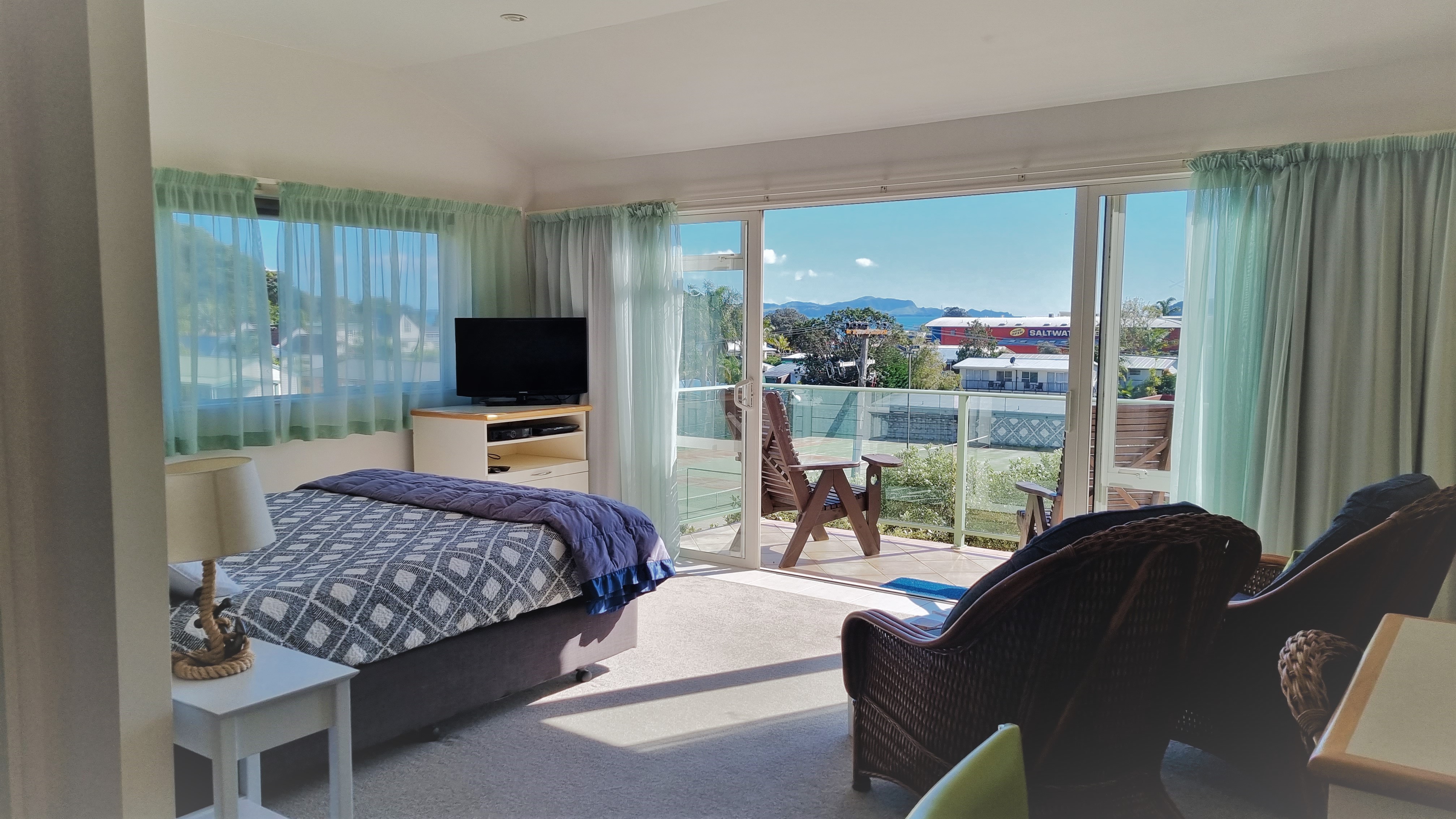
Admiral's View Motel offers a range of quality self-contained accommodation in Paihia, Bay of Islands, New Zealand. Relax in our peaceful accommodation in central Paihia – enjoy the sunny terraces with beautiful sea views overlooking the stunning Bay of Islands (from most units). Park your car and meander along to the beach, restaurants and cafés.
The Mangamuka Tramping Track takes you through scenic Raetea Forest, a track made for the adventurous at heart. This track takes approximately 9-10 hours to complete, and the terrain is varied. Beginning at SH1, for the first 2 hours, the track steadily climbs through pristine podocarp forest, surrounded by trees draped with moss. The track varies along an undulating saddle, which can be muddy in places, and offers good views to the west coast and the north. For the last 2 hours, the track winds downhill, through bush and onto the old Takahue Saddle Road. The Mangamuka Tramping Track is located south of Kaitaia. You can access the track from SH1, at the Mangamuka Gorge summit, or on State Highway 12, 12 km west of Kaitaia, off Takahue Saddle Road.
Note: Exits at both Mangamuka Gorge Summit and Takahue Saddle Road require transport back to Kaitaia.
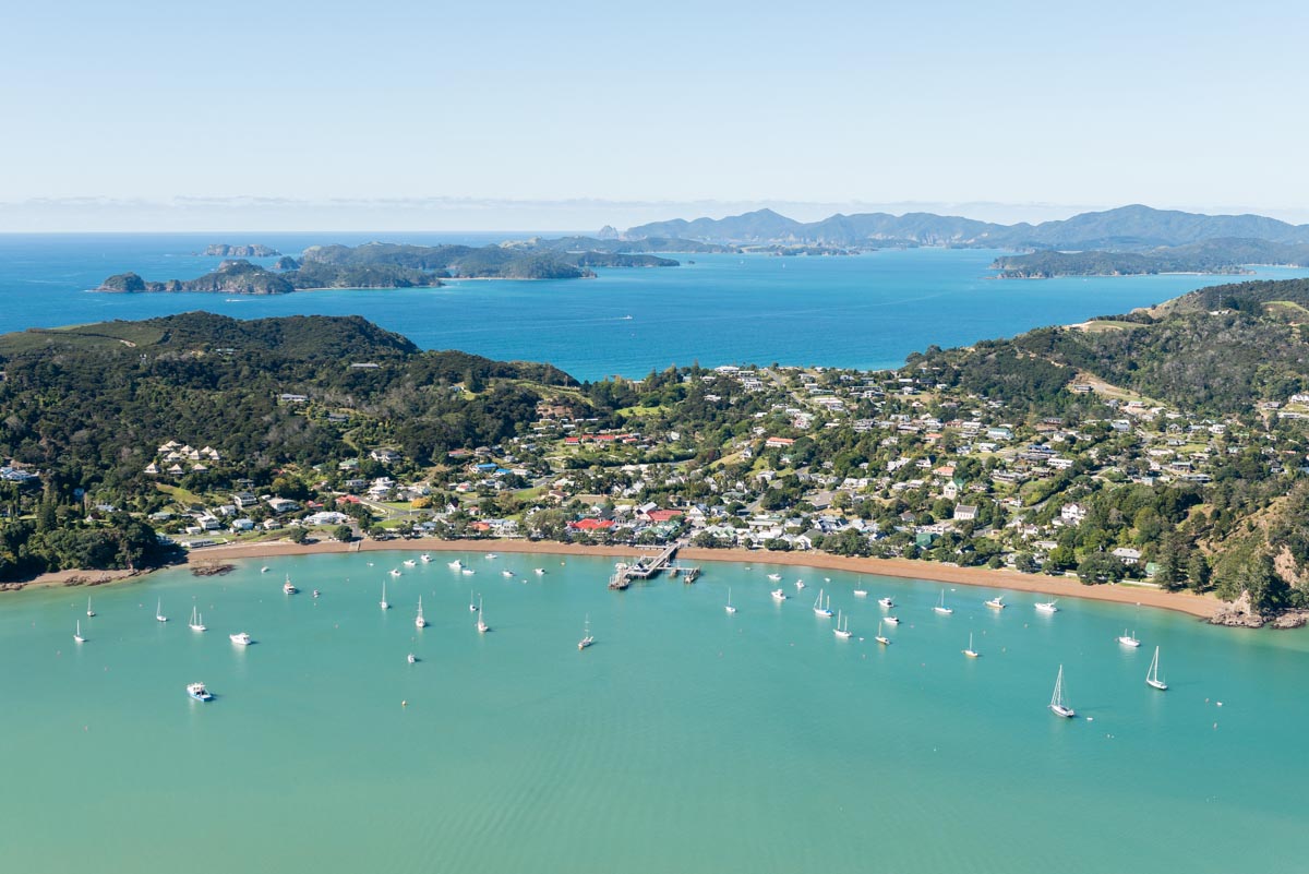
Paihia is known as the Bay of Islands' jewel and its Wharf and Harbour act as launching points for exploring the area. Cruises to the famed Hole in the Rock, dolphin encounters and more are all conducted from the wharf making it a pivotal point for your adventures in the region. There are also a number of restaurants on the wharf serving up delicious food and incredible views.
If you're not embarking on a tour nor are you looking to eat, you can simply walk along the wharf and enjoy the spectacular and relaxing views. The region is filled with so much natural beauty, you don't have to pay the big bucks to appreciate it. There are many restaraunts along the wharf, as the view into the Bay is stunning.
See a few listed below if you're keen on a meal: