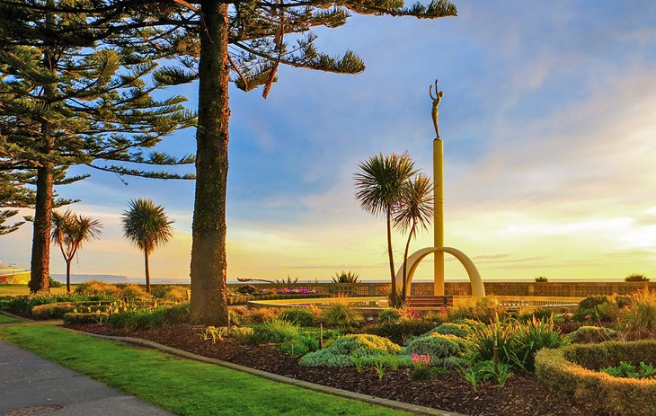
Whangarei
17.89°C

Whangarei
17.89°C
Waitakere City
16.98°C
Manukau City
17.11°C

Papakura
24.46°C
Hauraki
17.26°C

Waikato
17.67°C
Matamata
18.46°C
Hamilton
17.51°C
Otorohanga
18.52°C
Rotorua
16.6°C
Taupo
15.44°C
Tauranga
19.27°C
Kawerau
18.6°C
Whakatane
19.64°C
Gisborne
15.51°C
New Plymouth
16.98°C

Stratford
8.97°C
Ruapehu
14°C
Wanganui
17°C
Palmerston North
16.41°C
Wairoa
19.19°C
Hastings
18.84°C
Napier
18.49°C
Masterton
15.49°C
Carterton
15.66°C
Porirua
15.99°C
Lower Hutt
16.45°C

Wellington
15.79°C

Tasman
9.35°C
Nelson
16.27°C
Marlborough
3.22°C
Kaikoura
15.48°C
Christchurch
12.59°C
Ashburton
12.52°C
Timaru
13.37°C
Waitaki
11.32°C
Waimate
13.08°C

Queenstown
12.38°C
Dunedin
14.33°C
Southland
9.98°C
Gore
11.31°C
Invercargill
12.06°C
Blenheim
14.73°C
Te Anau
27.35°C
Wanaka
11.17°C
Kaikoura
13.38°C
Stratford
13.54°C
Upper Hutt
15.9°C
About


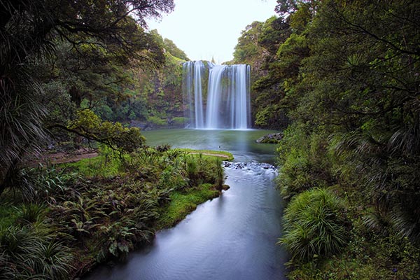
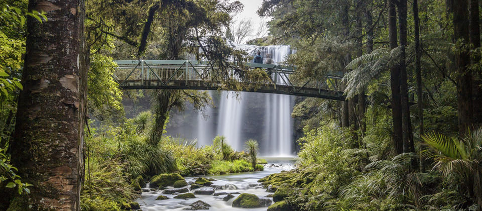
Otuihau Whangārei Falls is a picturesque 26.3 metre-high waterfall, cascading over basalt cliffs. Enjoy a relatively short circular walk or for a longer walk start from the A H Reed Memorial Park or Hatea River Walkway.
Whangarei Falls is located inWhangarei Scenic Reserve. The classic curtain waterfall is part of the Hatea River and one of the most popular swimming spot in the area. Easy access and a well-maintained Scenic Reserve make this waterfall one of New Zealand Must See Waterfalls.
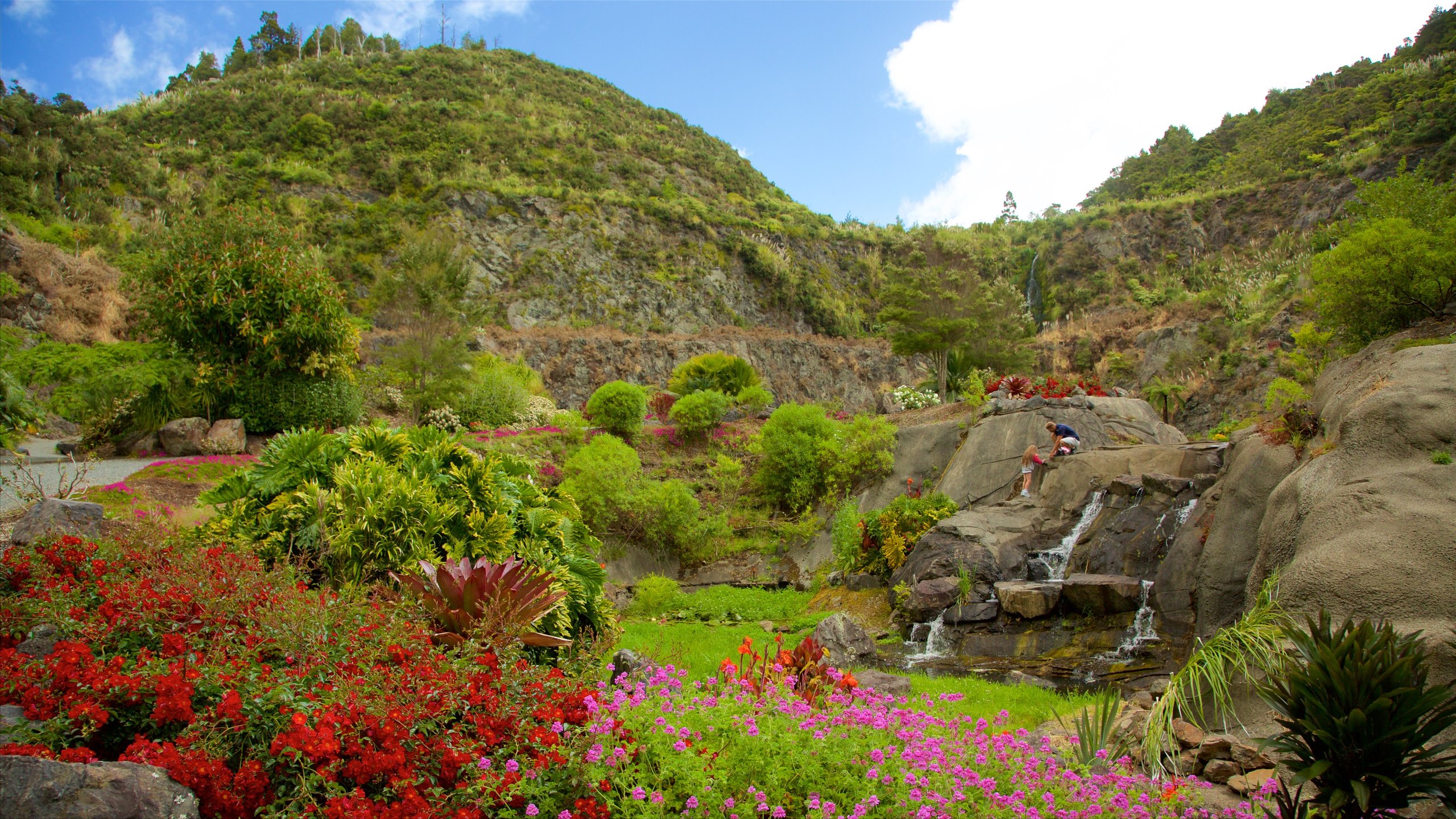
Whangarei Quarry Gardens is a community garden project created by volunteers in the forested western hills of Whangarei City. With the ongoing support of Whangarei District Council, Community Employment Groups and many loyal sponsors and friends, the once dilapidated quarry site has become a subtropical oasis for all to enjoy.
With an annual rainfall of 1500-2000 mm per year and New Zealand's highest average temperatures, Northland possesses a truly subtropical climate. At Whangarei Quarry Gardens these climatic conditions, coupled with the sheltered and heat-radiating properties of a stone quarry, create an ideal microclimate for growing a plethora of native and exotic subtropical plants.
Whangarei Quarry Gardens is a wonderful work in progress - historically fascinating, botanically captivating, and a beautiful reflection of the power of community.
Entry by donation
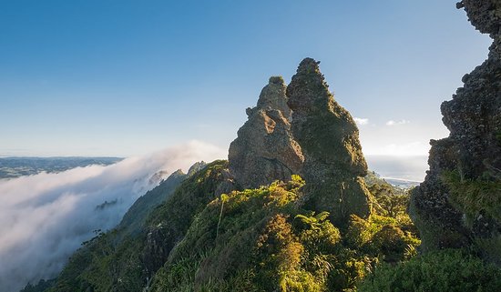
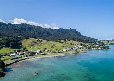
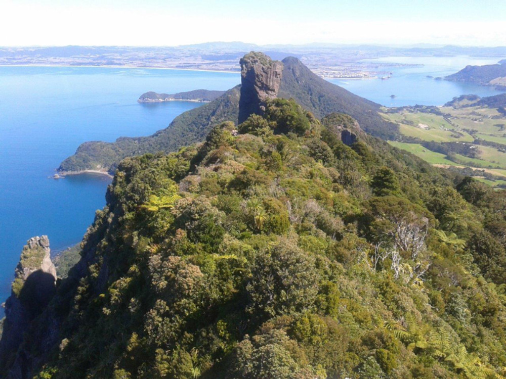
Wind your way through regenerating native forest to the summit of Mount Manaia, 420m above sea level.
As you climb, the landscape becomes increasingly spectacular, with views overlooking one of New Zealand's most dramatic harbour entrances. Along the way, check out the impressive stands of large tree ferns (punga) and natural rocky outcrops that are perfect lookouts for views of Bream Head and the Hen and Chicken Islands. To reach the mountain's true summit, you will need a strong head for heights, but the views from the top are well worth the effort.
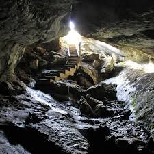
The Abbey Caves Reserve features dramatic limestone outcrops, sink holes and three significant caves; Organ, Middle and Ivy. A well-established native forest includes particularly fine specimens of puriri trees.
Access the abbey caves walkway over a steep wooden stile and down a series of box steps onto a circular walkway of mown grass. The three caves are signposted and lie just off this walkway. Only experienced cavers should enter the underground caves, as there are risks from rapidly rising water and roof falls. The Organ Cave entrance is dangerous due to a roof fall. The walkway comprises of naturally sculptured limestone outcrops, sink holes and three significant caves, Organ, Middle and Ivy. Along the walkway, you will see two distinct areas of native bush, podocarp-hardwood forest, specimens of puriri trees, and site of the historic house of Nathaniel and Amelia Clotworthy.
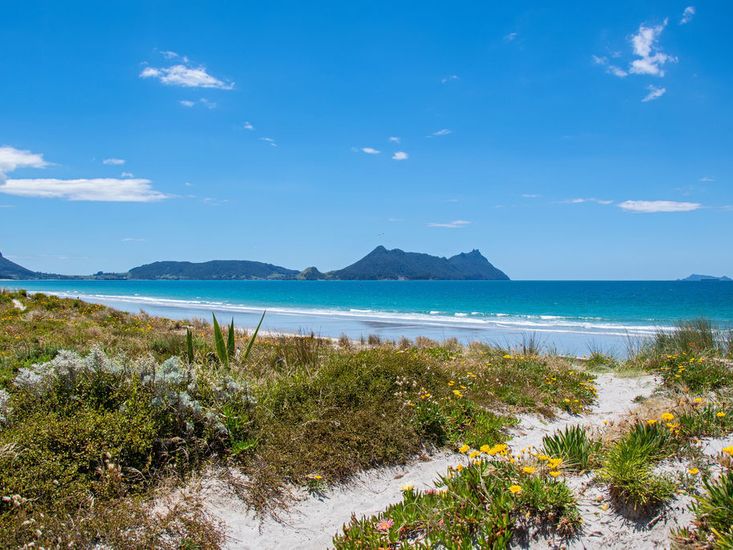
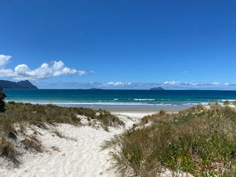
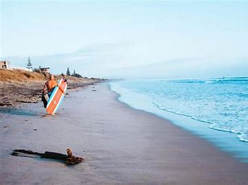
Ruakaka Beach is popular with swimmers, surfers and fishermen alike. It has a modest but growing resident population and good facilities including a surf club, shops and motor camp. Given the heavy industrial development of the Marsden Point area beach usage north of the Ruakaka River mouth is minimal.
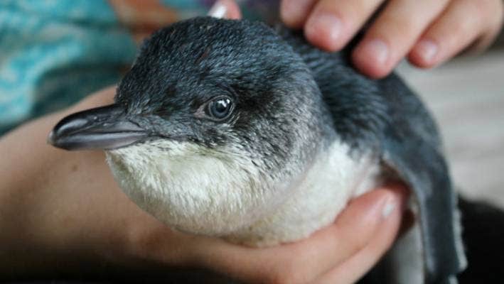
The award-winning Whangarei Native Bird Recovery Centre Incorporated has cared for and treated thousands of birds since 1st August 1992, when it was first established.
Centre founders Robert and Robyn Webb, who have over 30 years’ experience working with native birds, manage and run the centre with the help of a small committee of volunteers.
The centre takes in all injured birds, both native and non-native, and where possible nurses the birds back to health for release into the wild. More than 60% of the birds that are brought into the centre are successfully released again.
A special part of the centre is the Bayer incubation unit and kiwi recovery pens. This facility is used to incubate eggs found in the wild and also as a recovery area for injured kiwi.
In the Whangarei area, dogs are the biggest cause of kiwi deaths and injuries, followed by motor vehicles. Many of these injured kiwi end up at the Whangarei Native Bird Recovery Centre.
The centre’s diverse operations include:
Magnificent coastal views, a small rocky beach, Waipū pancake limestone rocks, native coastal bush, great fishing and picnic spots. This walk has been developed by members of the Waipū Lions Club following the vision of the late Alan McKenzie, who was a local resident.
The trail can be entered at either end where notices, stiles, orange markers and posts indicate the path. Following wet weather, the track becomes very slippery in areas. Part of the walkway is near a steep drop into the sea or onto rocks below, so take care and supervise youngsters. Alternatively, Langs Beach can be accessed by walking on the side of the road. This walk requires a reasonable level of fitness and agility. There are stiles, steps, ladders and rocks to climb. The entry / exit points at both Waipū Cove and Ding Bay may require you to wade through water. Please be aware of high tide times before you begin your walk. Please stay on the track, follow the orange markers and do not trespass onto private property.
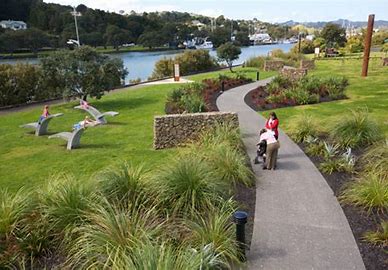
The entire loop circles the Hātea River, and is accessible for walking, jogging, pushbikes, mobility aids, scooters and push-chairs.
The walkway connects Town Basin, Te Matau a Pohe, William Fraser Memorial Park, Kotuitui Whitinga, Canopy Bridge, Clapham’s Clocks, Town Basin playground, Reyburn House gallery, a sculpture and heritage Trail, Riverbank Theatre, Waka and Wave Millennium sculpture, and Riverside Park along the way.
You can view a map of the walkway which includes the location of activities, sculptures, public toilets, carparks and other facilities.
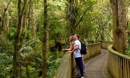
The A H Reed Memorial Park is a magnificent remnant of the original Northland kauri forest.
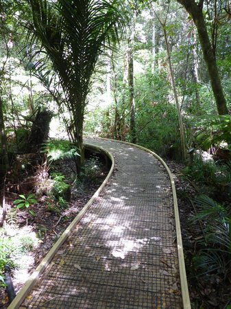
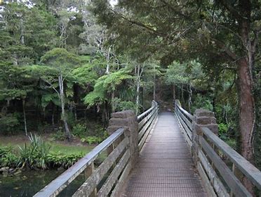
Maturing kauri trees known to be at least 500 years old can be easily viewed close up from a raised walkway through the forest canopy.
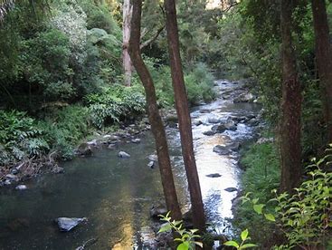
The bubbling Wai Koromiko Stream runs through the middle of the park and the Paranui Falls, at over 23m high, are well worth a visit.
The site received recreational reserve status in 1889 and was named in 1956 after the well known author and publisher A H Reed who had an interest in long distance walking, the natural environment and kauri trees in particular.
There are several loop tracks through the park, with one designed to be suited for people of all abilities including wheelchair users. Times given are for walking the tracks in one direction only.
There are three carparks for visitors to use.
The park can also be reached by walking from the Hatea River Walkway or from the Sands Rd/Clapham Rd link to the north.
The Canopy Walkway is an experience in itself and is considered to be a ‘must do’ for visitors to Whangārei. The park offers a variety of scenery and experiences for people of all abilities.
This walk begins at the end of Stuart Road in McLeod Bay and follows the coastline along a Department of Conservation (DOC) reserve.
Once you reach Darch Point Rd you have two options; One option is to walk to the end of Darch Point Rd and turn left onto Reotahi Rd which will take you back to Whangarei Heads Rd. The other option is to follow the Matuku St Link and Norfolk Avenue Link to Beach Rd to join up with the Reotahi Coastal walkway. This combines the two walks to form a longer coastal track passing by the Reotahi Marine Reserve and then the historic remains of the Meat Freezing Works with views to Marsden Point.
The walkway continues towards Little Munro Bay where you follow Bay View Rd up the hill until it meets Whangarei Heads Road. Turn left and follow the footpath back to where you started.
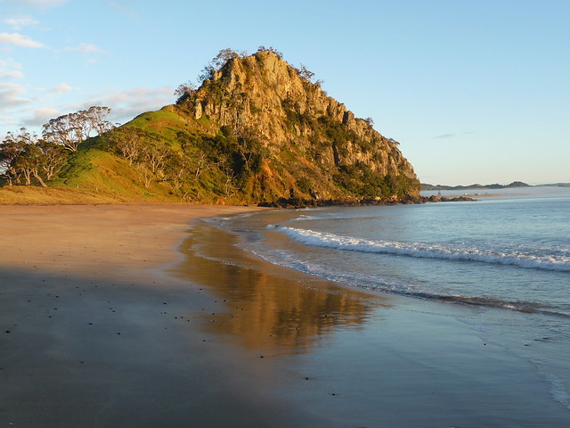
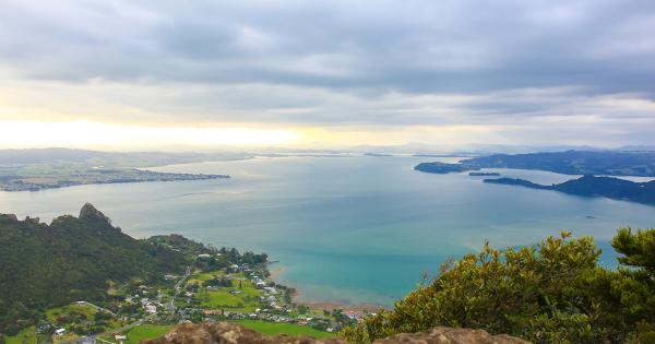
The Whangarei Heads in the Northland Region of New Zealand has a lot going for it, there are secluded beaches, beautiful native bush and stunning mountain walkways and the Mount Aubrey Reotahi Coastal Walkway loop is a stunning walk up through native bush to the Summit of Mount Aubrey.
There are two towering peaks on Mount Aubrey that are visible from sea level which are the remnants of an ancient volcano that once dominated the sky line here, the walk up Mount Aubrey is a loop walk that can be started from Reotahi Road and there is an easy way and a much more strenuous way to ascend the mountain.
The easier way is from a small carpark around one km along Reotahi Road on the left, there is a sign showing the start of the walk this accent is more maintained with gravel steps but there is only parking for five vehicles, the other way up the mountain is right at the end of Reotahi Road the carpark here accommodates more vehicles but the accent is more step and difficult this way.
From the midway carpark the steps dominate the climb up to the summit, there are stunning glimpses down onto the Whangarei harbor and Mcleod Bay through gaps in the trees, the summit will take around twenty minutes of moderate walking to reach the saddle at the top of the Mountain.
From the saddle and just as you finish the last step on the right side of the track is a diversion or side track this is a steep and rocky accent to the first look out and not for anyone scared of hieghts, up through the steep and loose rocky surface and a scramble up a barron rock face you get a 360 degree view of Whangarei Harbor and the east coast this is not recommended on a wet or windy day as the peak is very exposed to the elements.
Back down from the look out the saddle provides a great place to picnic there is an extensive area of grass here with stunning views down onto the Marsden Point refinery and the harbor entrance, with the more difficult part of the walk behind you the track passes along the side of the second rocky peak and there is a fork in the track the side track takes you up to the top of the second peak which is more or less the same scenario as the first peak and look out.
From the second peak the track winds around native bush and the odd rock or two before starting the steep decent down to the Reotahi Coastal Walkway, you will catch a glimpse of Busby Head through the trees and a little further along the track on the right side there is a pile of huge rocks walking out to the end of the pile is another stunning look out that looks back to the entrance of the harbor and down onto the beautiful bay below.
At the bottom of the decent the Reotahi Coastal Walkway starts and follows the coastline around the base of Mount Aubrey there are locations along the walkway with access to secluded beaches and rocky bays and the remnants of the Whangarei freezing works which was destroyed by fire in 1921.
The end of the walkway finishes at the second carpark and a short walk along Reotahi Road will take you back to the midway carpark, this is a great scenic walk suitable for all the family that will take around 1.5 hours to walk the full loop back to the carpark there are muddy sections on the decent even in the dry conditions we experienced so pick a suitable day to walk this track.
Looking for a great place to visit while in the Northland Region the Taiharuru Peninsula is one such destination, located around thirty kms North East of Whangarei city this area provides some stunning ocean views white sandy beaches and a walk up Kauri Mountain.
The Taiharuru Peninsula and Pataua are accessed from Pataua South Road on the way to Whangarei Heads this area is one big tidal estuary and a great place to explore the beautiful coastline on the Taiharuru Road there is a short coastal walk with stunning views, the walk sarts at the gap and follows the cliff top.
A little further along Taiharuru Road is a small coastal settlement and Taiharuru Bay this beautiful white sady beach is a great place to swim and take in the stunning views, you can also launch a kayak here in favorable conditions and explore the rocky coastline around to the tidal inlet.
Pataua South is at the very end of Pataua South Road and on the other side of the tidal inlet here there is a beautiful small estary with a sandy beach for swimming or head over the bridge by foot only to Pataua North and you have access to a wide sandy beach there is also a great short walk through the camping ground to the headland of Pataua South with fantastic views over the estaury.
Kauri Mountain Track is a short walk up Kauri Mountain with stunning views and is located just south of Taiharuru Peninsula and can be accessed from two locations the first is off Kauri Mountain Road and is not suitable for any large vehicle like a motorhome.
The second access point is from Harambee Road and a parking bay located by the post boxes the rest of the road is private, the walk is first up a steep metal road then through regenerating bush to the summit the views accross the extaury and North to Pataua are fantastic the walk is easy and will take around 1.5 hours one way.
Start from the Mahanga Rd car park and take a short walk along the Pataua Estuary and over a low hill to a lovely beach known as “Frog Town”.
If you turn left from Mahanga car park and walk along the water’s edge you will get to the Pataua Footbridge. This is a popular spot. The bridge takes you across to Pataua North and a further 20 minute stroll will get you to the Pataua North surf beach. You will have to return the same way but can do a loop walk by heading back on Pataua South Road and turning left into Mahanga Rd.
Pataua offers safe swimming in the estuary, although be careful of tidal pull. There is also fun for the older kids on the ocean side.
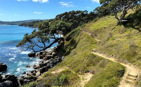
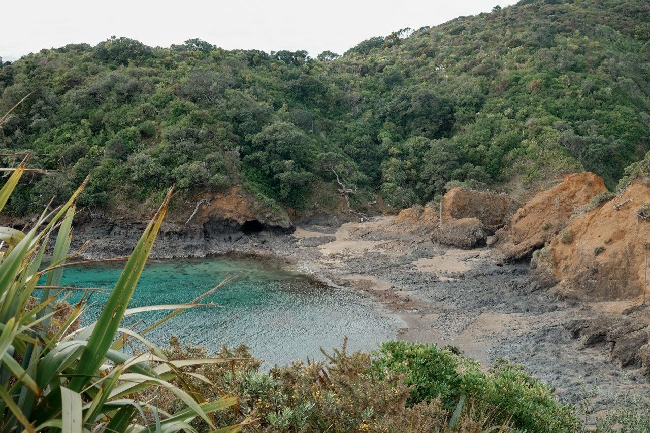
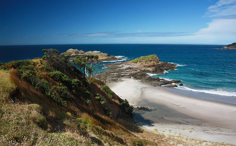
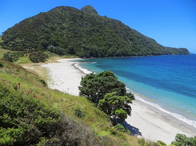
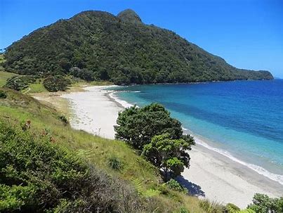
The 3-hour return walk along the Peach Cove Track requires skill and a reasonable level of fitness. The track has several steep climbs before it drops down to Peach Cove’s sandy beach. The track runs up one side of Bream Head Ridge and drops down the other side into Peach Cove, a pretty little sandy beach. You'll pass through attractive coastal broadleaf forest, and you can stay the night at the Peach Cove hut.
This track has lots of steep and narrow steps and is recommended for people who are reasonably fit and agile.
A section of the Peach Cove Track intersects with the Te Whara Track. There are alternative routes:
The nearby Mount Manaia Track is well worth a visit. The track has been upgraded and the views across the harbour are excellent.
The start of Peach Cove Track is signposted on the right about 4 km along Ocean Beach road.
Park just inside the entrance way as this access is a private driveway.
Follow in the footsteps of Northland's Māori ancestors. This challenging track climbs through coastal forest before revealing a spectacular 360-degree panorama. It's one of our best day hikes.
The Te Whara track follows an ancient Māori trail from Ocean Beach to Urquharts Bay.
The track passes through some of the best coastal forest in the North Island. At the Bream Head summit, towards the Ocean Beach end and not far from the ruins of a WWII radar station, enjoy a magnificent coastal panorama. Take in views of Cape Brett (Motukokako) in the north to Cape Rodney (Tawharanui) in the south, as well as the Poor Knights islands Tawhiti Rahi and Aorangi, Taranga and Marotere Islands in the Hen and Chickens Islands group, with Te Hauturu-o-Toi/Little Barrier and Great Barrier/Aotea Island in the far east.
Portland has developed around the mining and processing of limestone to make cement. This historic process is still alive today with Golden Bay Cement using the Whangarei Harbour to ship cement around the country. The Portland track gives a good vantage point from where this industrial heritage, both old and new can be viewed.
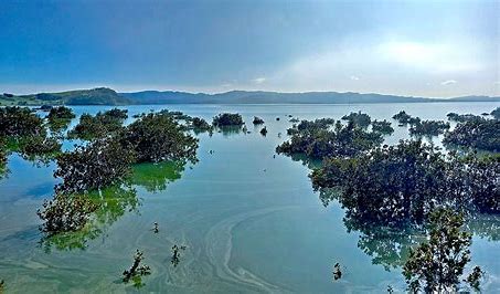
The track is essentially surfaced, winding through mangrove swamp and out to a rocky point. There are great views over the harbour and a variety of birdlife to be observed.
The Portland Track is accessed from Wharf Road Portland there is limited parking here on the side of the road, the track entrance is on the left hand side a bit hard too see at first and follows a paper road hugging the estuary shoreline.
When the tide is in you will need to follow the track which is a mixture of metal road and grass track when the tide recedes you can walk on the sandy shoreline this walk is easy and there is little elevation change on the walk which will take around 40 minutes return the mangrove trees and calm waters make an interesting short walk.
Huitau Pā is a historical Māori pā site overlooking McGregor’s Bay at Taiharuru, on the coast east of Whangārei. There are no visible remains of occupation.
The walkway overlooks “the gap” - a narrow cleft in the rocks, which can be a spectacular sight when the sea is rough. You can see beautiful views to the south, showing the Hen and Chicks Islands, and on a clear day include Little Barrier Island in the far distance. You can also enjoy extensive views of the small settlement of McGregor’s Bay.
The historical pā site at Taiharuru may not have any remnants left of its former occupation, but the 25-minute return walk along the edge of the cliffs is quite spectacular. Overlooking Whangarei’s east coast, Huitau Pā offers beautiful views across the ocean all the way to the Hen and Chicks Islands.
There is a small car park at what is known to locals as ‘the gap’, a narrow cleft between the rocks where the waves crash in thunderous motions when the sea gets rough. To get to Huitau Pā simply follow the signs for Whangarei Airport, then turn off towards Whangarei Heads. After passing through the small township of Parua Bay, turn right on Taiharuru Road. The walkway starts just before you reach McGregor’s Bay.
If you love amazing coastal views and don’t mind steep hill tracks the Tutukaka Lighthouse Walkway is well worth the effort. The entire walk takes about 1 hour (or longer if you want to spend ages gazing at the awe inspiring view).
It is important to set off within 1 hour either side of low tide, so that you don’t get stranded at the causeway when the tide comes in. You should wear good walking shoes.
When you reach the Tutukaka Lighthouse you get stunning views of the Poor Knights Islands, Tutukaka Harbour, Great Barrier Island and the coastline.
A grassy track follows the headland out across the reserve where native trees have been planted by local school-children. Seating is provided in several spots; there are views to the left of the track of the Poor Knights Islands.
The descent to the beach is a stepped and well maintained path, leading to a rocky/pebbly causeway across to Kukutauwhao Island. You can reach this beach whatever the tide is doing, but low tide is best to cross the causeway and follow the well marked track which climbs up the side of the island to the lighthouse, and great coastal views.
The return via the causeway gives you the opportunity to explore some of the nooks and inlet beaches which stretch to the right of the track before returning to the grassy reserve.
The track starts at the Whangarei District Council reserve, by the cave's entrance, off Waipu Caves Road. There is a large flat area suitable for picnics and a Whangārei District Council administered public toilet at this point.
Note: the entrance to the caves is directly across the Council Reserve before the track starts.
Look across the large flat grassed area for the orange post, which indicates the start of the track. Cross the large concrete culvert and start climbing your way out of the Waipu Caves valley.
The track passes through the Waipu Caves Scenic Reserve; after meandering among karst limestone formations it climbs up steeply, across areas of open grass and regenerating bush, before ending at a gate through to private farmland.
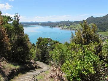
The track ends on the ridgeline where you will be rewarded with panoramic views right across the Whangārei Harbour to Bream Head and out to the Hen and Chicken Islands.
You must return back the same way.
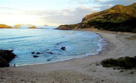
Matapouri Bay is an attractive beach location and it has a solid residential base that provides a good number of beach users during the summer. The bay is safe for the most part however care needs to be taken during large easterly swells that come directly into the bay. Matapouri Bay has no Lifeguarding Service.
Ruakaka Beach is popular with swimmers, surfers and fishermen alike. It has a modest but growing resident population and good facilities including a surf club, shops and motor camp. Given the heavy industrial development of the Marsden Point area beach usage north of the Ruakaka River mouth is minimal.
Trounson Kauri Park is home to several threatened species, including North Island brown kiwi, kereru (native pigeon), pekapeka (bats) and kauri snails. It’s also known for a magnificent stand of kauri trees - one of the best examples in the country.
The lush vegetation is dominated by kauri, taraire, kauri grass, kiekie, ferns and epiphytes. Kereru can be seen by day and, with patience, kiwi by night. Fantails, pied tits, ruru (native owls) and many other forest birds add their music to the forest.
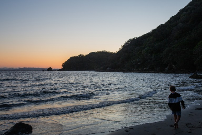
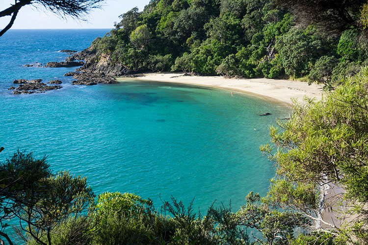
Ocean Beach is a popular location and it is good for numerous beach activities. Anyone intending on going into the water should seek advice from the Lifeguards and swimmers should always stick to the patrolled area.
The offers a fairly easy walk encompassing coastal forest, spectacular views, and a WWII era gun emplacement. The short one-way detour to the end of Busby Head is well worth the effort.
Alternatively, there is a direct route over the hill to Smugglers Bay, which takes about 15 minutes.
You will walk past the gun emplacement at Home Point. This was built during World War II as a defence against possible invasion. The six-inch naval gun was aimed with the help of a camouflaged radar station on the ridge above Ocean Beach. Inside the remote control room is a landscape painting of the Bream Bay area. It offers a unique interpretation of what the area look like before the construction of the Marsden Point Oil Refinery.
You can access Waikaraka Reserve directly from the small Council reserve located off the Whangārei Heads Road at Waikaraka.
Motukaroro Reserve is located at Reotahi. Turn onto Reotahi Road which is at the southern end of McLeod Bay, Whangārei Heads. Continue down Reotahi Road onto Beach Road. The car park is located at the end of Beach Road from which point you can walk down to the reserve.
Boat launching ramps are located at Onerahi, Parua Bay, Tamaterau, Reotahi, Urquhart Bay and across the harbour at Marsden Point, Marsden Bay and One Tree Point.
Follow the path of the beautiful Hātea River from the Town Basin to the impressive Whangārei Falls via Mair Park. The park was donated to the people of Whangārei in 1914 by Robert Mair, a local native plant enthusiast, and has been a popular picnic place for many years.
Dogs can be walked along the Hatea River walkway, but please keep them on a leash to protect our wildlife. Note: dogs are not allowed on tracks to the Parihaka summit or tracks within A H Reed Memorial Park.
Car parking is available at all five of these locations: Mair Park, Whareora Road, the A H Reed Memorial Park, Town Basin, and Whangārei Falls.
The track can be walked from the Town Basin all the way to the Whangārei Falls, but each section described below can be walked separately.
There are three walks that wind their way up to (or start at) the summit of Mt Parihaka. Mt Parihaka is the mountain prominently seen in the Whangarei skyline, offering amazing views of the city and harbour. Take either the Hokianga/Dobbie Track (50-minutes one-way) and Drummond Track (40-minutes one-way) from Mair Park or from the summit car park. Alternatively, take the 40-minute Ross Track from Dundas Road. All these tracks are grade 3 bike trails too.
Location: Drive to the summit via Memorial Drive. The Hokianga/Dobbie Track and Drummond Track to the summit starts from Mair Park. The Ross Track starts from Dundas Road.
Another stunning walk at Whangarei Heads is a 3km (2-mile) loop past a World War 2 gun emplacement, coastal forest and to the secluded Smugglers Bay. Alternatively, there is a 20-minute track over farmland to Smugglers Bay.
Location: Whangarei Heads. Start from the Urquharts Bay car park off Urquharts Bay Road at the end of the Whangarei Heads Road.
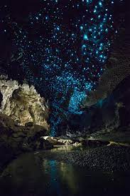
Waipu is a small town in Bream Bay, in the Northland Region of New Zealand, with a Scottish heritage. Just outside the town are the Waipu Caves, which contain a significant population of glow worms. Scramble through Waipu Caves where the 175m long main cave reveals one of the tallest stalagmites in New Zealand, an enormous 8 feet high. The huge limestone cave system covers some four square kilometres and is home to millions of glow worms adorning the cavernous ceilings and freshwater koura in the chilly pools below. 41 km south of Whāngārei. It was founded in the mid-19th century by Scottish settlers from Nova Scotia, led by the charismatic preacher Norman McLeod. Facing economic hardship in Canada, the group went first to Australia and then to New Zealand. In 1854 they secured land at Waipū, and were joined by more Scots from Nova Scotia and Scotland.
Filled with great cafes and restaraunts, including amazing pizza and beer at Mcleods Brewery!
Paranui Falls, also known as Pukenui Falls, is located at A.H.Reed Memorial Park, Whangarei. The waterfall is usually overlooked because of the most popular neighbor - Whangarei Falls and doesn't get the attention it deserves.
Paranui Falls is roughly a 10-minutes' drive away from Whangarei City center or 2.5-hours from Auckland. The road surface is always sealed.
From Auckland travel north on the SH1. In Whangarei turn right into Kensington Ave, then continue on Nixon St. Turn left into Mill Rd and follow it for the next 650 m, then turn right into Whareora Rd and stay on it for the next 2 km. On the intersection, turn left into Clapham Rd and follow it for the next 100 m. There is a small car park at Clapham Rd (on your left) with no facilities there.
A walking track starts from the parking and descends to the waterfall's base. It takes 10-15 minutes to reach the falls. Frist part of the trail goes through the forest and has lots of tree roots on it. The last part of the track follows the riverbed with lots of river stones. Be very careful - the stones are always slippery. Return via the same track.