Whangarei
17.89°C

Whangarei
17.89°C
Waitakere City
16.98°C
Manukau City
17.11°C

Papakura
24.46°C
Hauraki
17.26°C

Waikato
17.67°C
Matamata
18.46°C
Hamilton
17.51°C
Otorohanga
18.52°C
Rotorua
16.6°C
Taupo
15.44°C
Tauranga
19.27°C
Kawerau
18.6°C
Whakatane
19.64°C
Gisborne
15.51°C
New Plymouth
16.98°C

Stratford
8.97°C
Ruapehu
14°C
Wanganui
17°C
Palmerston North
16.41°C
Wairoa
19.19°C
Hastings
18.84°C
Napier
18.49°C
Masterton
15.49°C
Carterton
15.66°C
Porirua
15.99°C
Lower Hutt
16.45°C

Wellington
15.79°C

Tasman
9.35°C
Nelson
16.27°C
Marlborough
3.22°C
Kaikoura
15.48°C
Christchurch
12.59°C
Ashburton
12.52°C
Timaru
13.37°C
Waitaki
11.32°C
Waimate
13.08°C

Queenstown
12.38°C
Dunedin
14.33°C
Southland
9.98°C
Gore
11.31°C
Invercargill
12.06°C
Blenheim
14.73°C
Te Anau
27.35°C
Wanaka
11.17°C
Kaikoura
13.38°C
Stratford
13.54°C
Upper Hutt
15.9°C
About
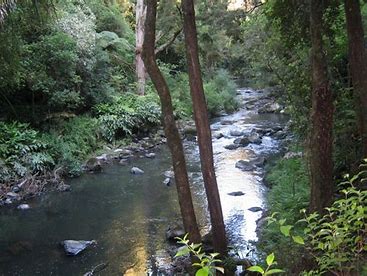
Follow the path of the beautiful Hātea River from the Town Basin to the impressive Whangārei Falls via Mair Park. The park was donated to the people of Whangārei in 1914 by Robert Mair, a local native plant enthusiast, and has been a popular picnic place for many years.
Dogs can be walked along the Hatea River walkway, but please keep them on a leash to protect our wildlife. Note: dogs are not allowed on tracks to the Parihaka summit or tracks within A H Reed Memorial Park.
Car parking is available at all five of these locations: Mair Park, Whareora Road, the A H Reed Memorial Park, Town Basin, and Whangārei Falls.
The track can be walked from the Town Basin all the way to the Whangārei Falls, but each section described below can be walked separately.


