Whangarei
17.89°C

Whangarei
17.89°C

Waitakere City
16.98°C

Manukau City
17.11°C

Papakura
24.46°C

Hauraki
17.26°C

Waikato
17.67°C

Matamata
18.46°C

Hamilton
17.51°C

Otorohanga
18.52°C

Rotorua
16.6°C

Taupo
15.44°C

Tauranga
19.27°C

Kawerau
18.6°C

Whakatane
19.64°C

Gisborne
15.51°C

New Plymouth
16.98°C

Stratford
8.97°C

Ruapehu
14°C

Wanganui
17°C

Palmerston North
16.41°C

Wairoa
19.19°C

Hastings
18.84°C

Napier
18.49°C

Masterton
15.49°C

Carterton
15.66°C

Porirua
15.99°C

Lower Hutt
16.45°C

Wellington
15.79°C

Tasman
9.35°C

Nelson
16.27°C

Marlborough
3.22°C

Kaikoura
15.48°C

Christchurch
12.59°C

Ashburton
12.52°C

Timaru
13.37°C

Waitaki
11.32°C

Waimate
13.08°C

Queenstown
12.38°C

Dunedin
14.33°C

Southland
9.98°C

Gore
11.31°C

Invercargill
12.06°C

Blenheim
14.73°C

Te Anau
27.35°C

Wanaka
11.17°C

Kaikoura
13.38°C

Stratford
13.54°C

Upper Hutt
15.9°C

About
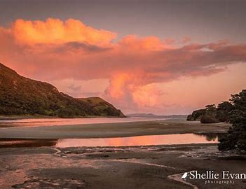
Houhora Heads is an easy-to-spot landmark, Mt. Camel (Mt. Houhora) was the first part of New Zealand that the early explorer Kupe saw, but he thought it was a whale, according to Māori legend. The harbour is long and narrow, mostly sheltered but with exposed sand banks at low tide. There is a deep channel along the southern shore as far as Pukenui Wharf. Mt Camel/Tohoraha (also called Mt Houhora) is a 236-metre hill forming the North Head. The South Head is a flat area.
