Whangarei
17.89°C

Whangarei
17.89°C
Waitakere City
16.98°C
Manukau City
17.11°C

Papakura
24.46°C
Hauraki
17.26°C

Waikato
17.67°C
Matamata
18.46°C
Hamilton
17.51°C
Otorohanga
18.52°C
Rotorua
16.6°C
Taupo
15.44°C
Tauranga
19.27°C
Kawerau
18.6°C
Whakatane
19.64°C
Gisborne
15.51°C
New Plymouth
16.98°C

Stratford
8.97°C
Ruapehu
14°C
Wanganui
17°C
Palmerston North
16.41°C
Wairoa
19.19°C
Hastings
18.84°C
Napier
18.49°C
Masterton
15.49°C
Carterton
15.66°C
Porirua
15.99°C
Lower Hutt
16.45°C

Wellington
15.79°C

Tasman
9.35°C
Nelson
16.27°C
Marlborough
3.22°C
Kaikoura
15.48°C
Christchurch
12.59°C
Ashburton
12.52°C
Timaru
13.37°C
Waitaki
11.32°C
Waimate
13.08°C

Queenstown
12.38°C
Dunedin
14.33°C
Southland
9.98°C
Gore
11.31°C
Invercargill
12.06°C
Blenheim
14.73°C
Te Anau
27.35°C
Wanaka
11.17°C
Kaikoura
13.38°C
Stratford
13.54°C
Upper Hutt
15.9°C
About
This recreation area has been developed on conservation land at the edge of the Waikawa Forest, which was last logged in the 1960s. The access roads are old saw milling roads and the picnic site was once a skid site where logs were hauled and loaded for transport.
From the picnic site there is an easy access short bush walk that is suitable for wheelchairs. It explores an excellent example of a typical Catlins coastal forest with an impressive range of tree and fern species. This is a registered Kiwi Walk.
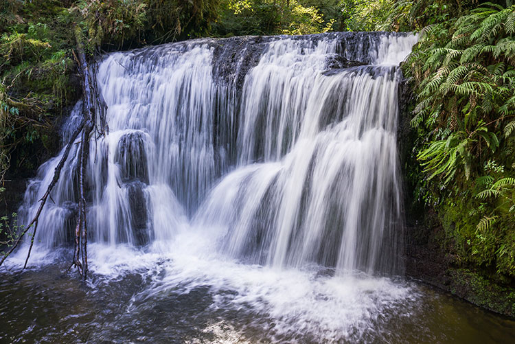
There is also a longer, 3 hour tramping track that leads to two waterfalls: the upper Waipohatu Falls - Pouriwai Falls and the Lower Waipohatu Falls - Punehu Falls. It requires average physical fitness and can be walked return or as a loop. This track has been recently upgraded as a result of a joint effort by the local Promotions group and the Toi Tois Lions Club. Two new bridges have been put in and new directional signs added.


