Whangarei
17.89°C

Whangarei
17.89°C
Waitakere City
16.98°C
Manukau City
17.11°C

Papakura
24.46°C
Hauraki
17.26°C

Waikato
17.67°C
Matamata
18.46°C
Hamilton
17.51°C
Otorohanga
18.52°C
Rotorua
16.6°C
Taupo
15.44°C
Tauranga
19.27°C
Kawerau
18.6°C
Whakatane
19.64°C
Gisborne
15.51°C
New Plymouth
16.98°C

Stratford
8.97°C
Ruapehu
14°C
Wanganui
17°C
Palmerston North
16.41°C
Wairoa
19.19°C
Hastings
18.84°C
Napier
18.49°C
Masterton
15.49°C
Carterton
15.66°C
Porirua
15.99°C
Lower Hutt
16.45°C

Wellington
15.79°C

Tasman
9.35°C
Nelson
16.27°C
Marlborough
3.22°C
Kaikoura
15.48°C
Christchurch
12.59°C
Ashburton
12.52°C
Timaru
13.37°C
Waitaki
11.32°C
Waimate
13.08°C

Queenstown
12.38°C
Dunedin
14.33°C
Southland
9.98°C
Gore
11.31°C
Invercargill
12.06°C
Blenheim
14.73°C
Te Anau
27.35°C
Wanaka
11.17°C
Kaikoura
13.38°C
Stratford
13.54°C
Upper Hutt
15.9°C
About
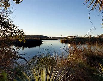
Travis Wetland is located in north-east Christchurch, close to sea-level, and is typical of pre-European Christchurch and Canterbury plains swamp lands.
1600 years ago it was an estuary similar to the Avon/Heathcote Estuary of today. A sandbar gradually shut out the sea, decreasing salinity and allowing wetland plants to take over from saltmarsh species.
Travis is the largest wetland in Christchurch with an area of 56.5 hectares, and is unique in the fact that it is situated in an urban area. Bounded by Mairehau, Frosts, and Travis Roads, this area is Christchurch’s last major piece of freshwater wetland. When you consider that Christchurch was built from a swamp, these remaining wetlands become a very important part of our history and heritage.
Travis Wetlands were one of the mahinga kai (traditional resource gathering areas) and used by Waitaha from about 900AD, Kati Mamoe from about 1600, and by Ngai Tahu from about 1650. Queen Elizabeth II Park now occupies the land (known as Oruapaeroa) that was the residential area for the families of Ngai Tahu who harvested these wetlands. Eel, fish, kereru, raupo seeds, and other wildlife were in abundant supply. Harakeke was used for weaving baskets, clothing, and roofing, and raupo was used for thatch. In the mid 19th century the whare of Oruapaeroa were still standing but were burnt down in 1862 when a European settler gained crown grant of the land. Māori had requested that this ancient pa site be excluded when Kemp's Purchase of 1848 was drawn up, but this did not happen.
Only a decade ago, these wetlands were grazed by cattle and looked like becoming yet another housing development. The Travis Wetland Trust lobbied the Christchurch City Council to step in and buy the land which they did in 1996.
Travis Wetland is an important site for local and regional conservation of wetland plants. Among the plants here are manuka, the tall baumea reed, a spider orchid, and other small herbaceous plants. These survivors nestle within the predominant vegetation of rushes, sedges, grasses, herbs, New Zealand flax, raupo, and ferns. Some of the native plants here were thought to be locally extinct.


