Whangarei
17.89°C

Whangarei
17.89°C
Waitakere City
16.98°C
Manukau City
17.11°C

Papakura
24.46°C
Hauraki
17.26°C

Waikato
17.67°C
Matamata
18.46°C
Hamilton
17.51°C
Otorohanga
18.52°C
Rotorua
16.6°C
Taupo
15.44°C
Tauranga
19.27°C
Kawerau
18.6°C
Whakatane
19.64°C
Gisborne
15.51°C
New Plymouth
16.98°C

Stratford
8.97°C
Ruapehu
14°C
Wanganui
17°C
Palmerston North
16.41°C
Wairoa
19.19°C
Hastings
18.84°C
Napier
18.49°C
Masterton
15.49°C
Carterton
15.66°C
Porirua
15.99°C
Lower Hutt
16.45°C

Wellington
15.79°C

Tasman
9.35°C
Nelson
16.27°C
Marlborough
3.22°C
Kaikoura
15.48°C
Christchurch
12.59°C
Ashburton
12.52°C
Timaru
13.37°C
Waitaki
11.32°C
Waimate
13.08°C

Queenstown
12.38°C
Dunedin
14.33°C
Southland
9.98°C
Gore
11.31°C
Invercargill
12.06°C
Blenheim
14.73°C
Te Anau
27.35°C
Wanaka
11.17°C
Kaikoura
13.38°C
Stratford
13.54°C
Upper Hutt
15.9°C
About
Takarunga is the original Māori name and means ‘hill standing above’, which is in reference to its height above adjacent Takararo / Mt Cambria which was a third maunga in Devonport. Sadly, Takararo was completely levelled by quarrying and is now the flat park known as Mt Cambria Reserve.
European settlers named the maunga Mt Victoria, after Queen Victoria. Another early European name for the maunga was Flagstaff Hill, after a signal station for the Port of Auckland was positioned on the summit in 1841. Takarunga / Mt Victoria has been a public reserve since 1880.
Used as a military position against a feared Russian invasion at the end of the 19th century, Takarunga / Mt Victoria has one of the last remaining disappearing guns in the world.
Takarunga is another former Māori pā (fortified village settlement). The northern slopes are largely original terracing dating to the pā, and pā storage pits are visible here on the upper slopes.
Although this maunga has been heavily modified in post-European times, it’s important to tread carefully and avoid walking on or through the historic terracing and pits. Please help preserve the history that still survives and stick to the formal tracks and sealed paths where they exist.
Start the path on King Edward Parade, by the water. Head up Church Street and turn left onto Kerr Street. Access the walk to the tihi (summit) from the signed access point off Kerr Street.
The tihi and summit road at Takarunga / Mt Victoria is permanently closed to private motor vehicles, making it a safer and more peaceful place for walking and cycling.
Dotted around the summit of the maunga you will come across a number of colourfully painted mushroom features. These are in fact the vents for a water pumping station which lies underneath the surface of the maunga.
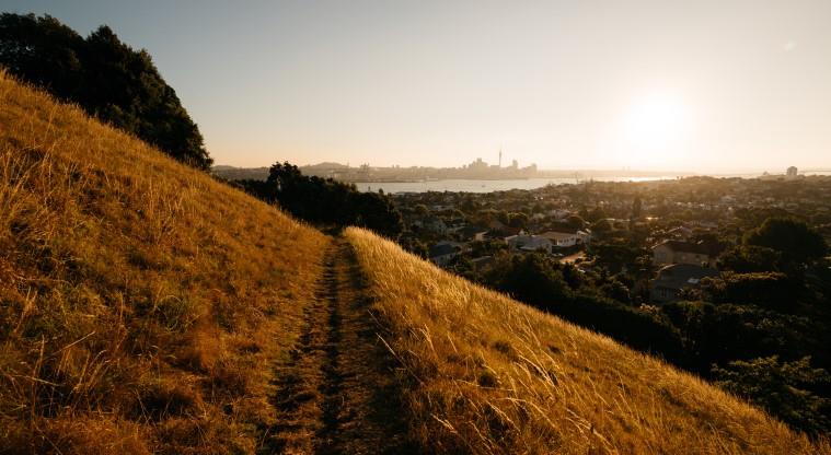
Takarunga / Mt Victoria is a great place for stunning views across the Waitematā to the city centre and is also a great viewing place for watching ships arriving and departing.
Takarunga / Mt Victoria is one of 14 Tūpuna Maunga co-governed by the Tūpuna Maunga Authority.


