Whangarei
17.89°C

Whangarei
17.89°C
Waitakere City
16.98°C
Manukau City
17.11°C

Papakura
24.46°C
Hauraki
17.26°C

Waikato
17.67°C
Matamata
18.46°C
Hamilton
17.51°C
Otorohanga
18.52°C
Rotorua
16.6°C
Taupo
15.44°C
Tauranga
19.27°C
Kawerau
18.6°C
Whakatane
19.64°C
Gisborne
15.51°C
New Plymouth
16.98°C

Stratford
8.97°C
Ruapehu
14°C
Wanganui
17°C
Palmerston North
16.41°C
Wairoa
19.19°C
Hastings
18.84°C
Napier
18.49°C
Masterton
15.49°C
Carterton
15.66°C
Porirua
15.99°C
Lower Hutt
16.45°C

Wellington
15.79°C

Tasman
9.35°C
Nelson
16.27°C
Marlborough
3.22°C
Kaikoura
15.48°C
Christchurch
12.59°C
Ashburton
12.52°C
Timaru
13.37°C
Waitaki
11.32°C
Waimate
13.08°C

Queenstown
12.38°C
Dunedin
14.33°C
Southland
9.98°C
Gore
11.31°C
Invercargill
12.06°C
Blenheim
14.73°C
Te Anau
27.35°C
Wanaka
11.17°C
Kaikoura
13.38°C
Stratford
13.54°C
Upper Hutt
15.9°C
About
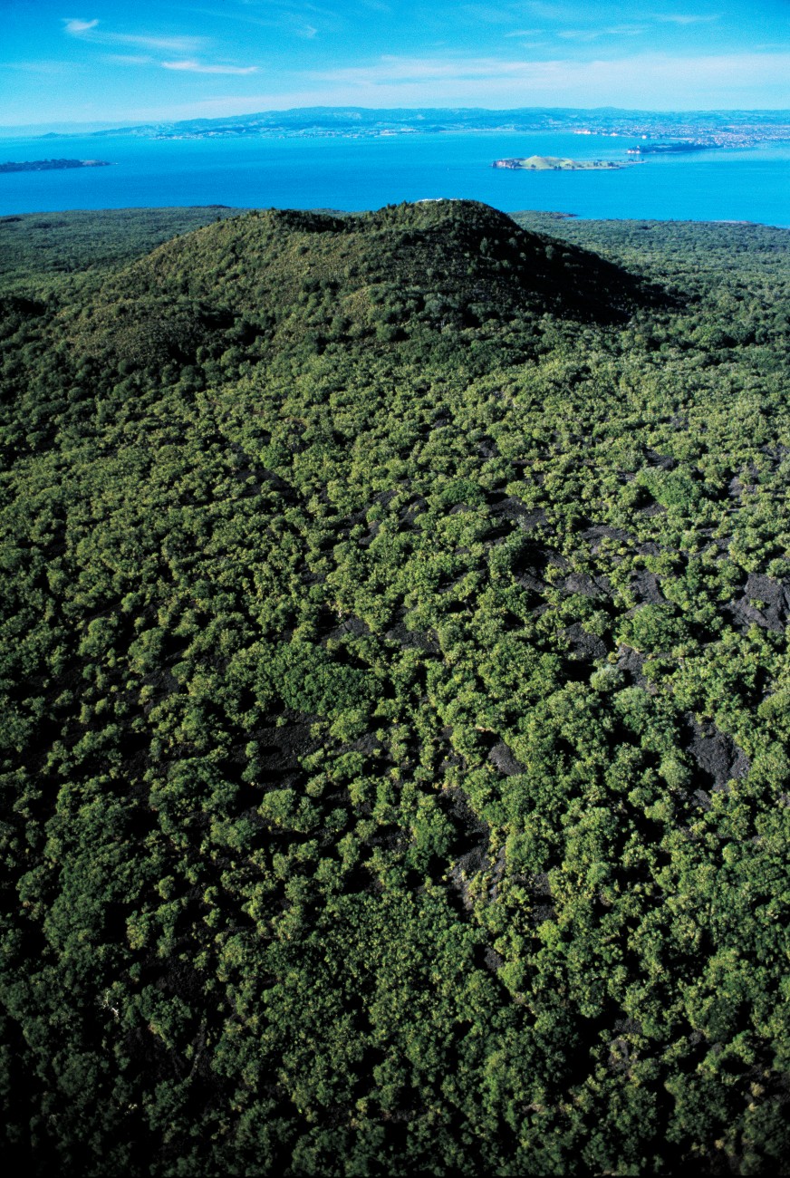
The Rangitoto Summit Track is a popular hiking trail located on Rangitoto Island, an iconic volcanic island situated just off the coast of Auckland, New Zealand. This scenic trail offers an exciting outdoor adventure that combines natural beauty, volcanic landscapes, and panoramic views of the surrounding area.
The hike to Rangitoto Summit begins at the island's wharf, where visitors arrive by ferry. The well-marked track takes you through native forests, across lava fields, and up the slopes of the dormant volcano. Along the way, you'll encounter unique volcanic rock formations and witness the regenerating flora that has flourished on the island.
As you ascend toward the summit, you'll be rewarded with breathtaking views of Auckland's skyline, the Hauraki Gulf, and the neighboring islands. The panoramic vistas are especially spectacular during sunrise and sunset, offering photographers and nature enthusiasts the perfect backdrop for their adventures.
At the summit, you'll find the iconic Rangitoto Island trig station, which is a popular spot for taking in the scenery, picnicking, and soaking up the island's natural beauty. The panoramic views from the summit are a testament to the volcanic origins of the island and the stunning landscapes that have developed over time.
The Rangitoto Summit Track is a moderate hike that can be completed in a few hours, making it accessible to a wide range of hikers. It's an excellent opportunity to connect with nature, explore volcanic landscapes, and enjoy the picturesque beauty of Auckland's coastal environment.
Whether you're a hiking enthusiast, a nature lover, or simply someone looking for a memorable outdoor experience, the Rangitoto Summit Track offers a rewarding journey to the summit of one of Auckland's most iconic volcanoes, complete with breathtaking views and a glimpse into New Zealand's unique geological history.


