Whangarei
17.89°C

Whangarei
17.89°C
Waitakere City
16.98°C
Manukau City
17.11°C

Papakura
24.46°C
Hauraki
17.26°C

Waikato
17.67°C
Matamata
18.46°C
Hamilton
17.51°C
Otorohanga
18.52°C
Rotorua
16.6°C
Taupo
15.44°C
Tauranga
19.27°C
Kawerau
18.6°C
Whakatane
19.64°C
Gisborne
15.51°C
New Plymouth
16.98°C

Stratford
8.97°C
Ruapehu
14°C
Wanganui
17°C
Palmerston North
16.41°C
Wairoa
19.19°C
Hastings
18.84°C
Napier
18.49°C
Masterton
15.49°C
Carterton
15.66°C
Porirua
15.99°C
Lower Hutt
16.45°C

Wellington
15.79°C

Tasman
9.35°C
Nelson
16.27°C
Marlborough
3.22°C
Kaikoura
15.48°C
Christchurch
12.59°C
Ashburton
12.52°C
Timaru
13.37°C
Waitaki
11.32°C
Waimate
13.08°C

Queenstown
12.38°C
Dunedin
14.33°C
Southland
9.98°C
Gore
11.31°C
Invercargill
12.06°C
Blenheim
14.73°C
Te Anau
27.35°C
Wanaka
11.17°C
Kaikoura
13.38°C
Stratford
13.54°C
Upper Hutt
15.9°C
About
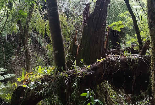
This is a great short walk and the track is easy to follow. Although there are some steep parts it is within most people’s capabilities. Children will be able to tackle this walk easily, provided they’re big enough to walk up steps and can endure an hour of gentle walking.
At the first big kahikatea, look left and you’ll see an open, grassy area providing stunning views out across the Mangaweka river terraces and the cliffs cradling the Rangitikei River, to the Ruahine Ranges. Further on, the track heads into forest with large matai, rimu, tawa and titoki trees.
From Mangaweka, drive south and turn right onto Te Kapua Road. Follow this for about 600m until you reach a little off-road carpark by a farm gate on the right-hand side of the road. The track begins on the other side of the road, so beware of traffic


