Whangarei
17.89°C

Whangarei
17.89°C
Waitakere City
16.98°C
Manukau City
17.11°C

Papakura
24.46°C
Hauraki
17.26°C

Waikato
17.67°C
Matamata
18.46°C
Hamilton
17.51°C
Otorohanga
18.52°C
Rotorua
16.6°C
Taupo
15.44°C
Tauranga
19.27°C
Kawerau
18.6°C
Whakatane
19.64°C
Gisborne
15.51°C
New Plymouth
16.98°C

Stratford
8.97°C
Ruapehu
14°C
Wanganui
17°C
Palmerston North
16.41°C
Wairoa
19.19°C
Hastings
18.84°C
Napier
18.49°C
Masterton
15.49°C
Carterton
15.66°C
Porirua
15.99°C
Lower Hutt
16.45°C

Wellington
15.79°C

Tasman
9.35°C
Nelson
16.27°C
Marlborough
3.22°C
Kaikoura
15.48°C
Christchurch
12.59°C
Ashburton
12.52°C
Timaru
13.37°C
Waitaki
11.32°C
Waimate
13.08°C

Queenstown
12.38°C
Dunedin
14.33°C
Southland
9.98°C
Gore
11.31°C
Invercargill
12.06°C
Blenheim
14.73°C
Te Anau
27.35°C
Wanaka
11.17°C
Kaikoura
13.38°C
Stratford
13.54°C
Upper Hutt
15.9°C
About
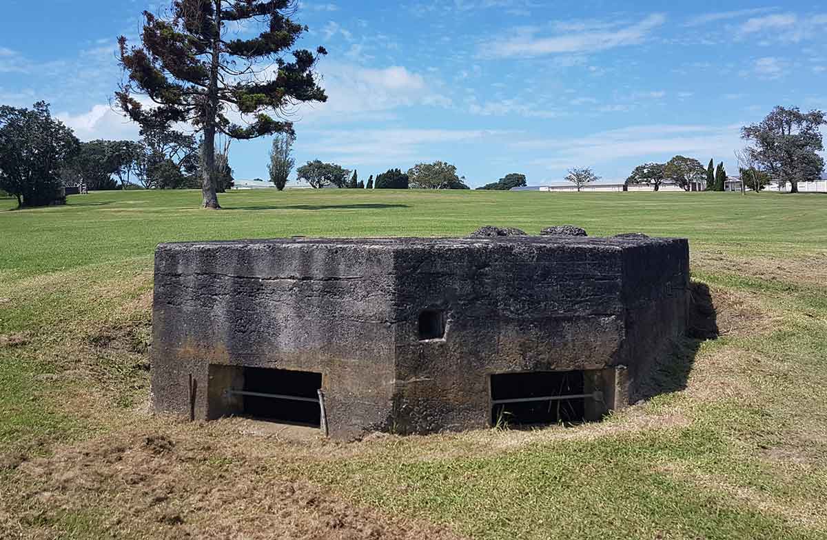
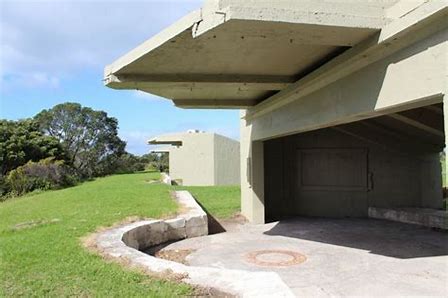
The grounds of Fort Takapuna is on a commanding position at the head of the Rangitoto Channel in the Hauraki Gulf. This made it an important lookout and defence site for hundreds of years, first for early Maori inhabitants and later for European settlers.
The area has been known by a number of names over the years: Fort Cautley, HMNZS Tamaki, and Narrow Neck. The original military title for the area is ‘Fort Takapuna’, named for the point on which it stands.
Features of the fort included twin six-inch disappearing guns, an underground magazine, barracks, observation posts, and engine room and searchlights. The structures situated on this site form a unique historic complex containing elements from all periods of coastal defence in New Zealand. The old fort, the last of the New Zealand designed twin 6 inch gun forts, was designed by Major Tudor-Boddam of the Royal Artillery and built between 1886 and 1889.