Whangarei
17.89°C

Whangarei
17.89°C
Waitakere City
16.98°C
Manukau City
17.11°C

Papakura
24.46°C
Hauraki
17.26°C

Waikato
17.67°C
Matamata
18.46°C
Hamilton
17.51°C
Otorohanga
18.52°C
Rotorua
16.6°C
Taupo
15.44°C
Tauranga
19.27°C
Kawerau
18.6°C
Whakatane
19.64°C
Gisborne
15.51°C
New Plymouth
16.98°C

Stratford
8.97°C
Ruapehu
14°C
Wanganui
17°C
Palmerston North
16.41°C
Wairoa
19.19°C
Hastings
18.84°C
Napier
18.49°C
Masterton
15.49°C
Carterton
15.66°C
Porirua
15.99°C
Lower Hutt
16.45°C

Wellington
15.79°C

Tasman
9.35°C
Nelson
16.27°C
Marlborough
3.22°C
Kaikoura
15.48°C
Christchurch
12.59°C
Ashburton
12.52°C
Timaru
13.37°C
Waitaki
11.32°C
Waimate
13.08°C

Queenstown
12.38°C
Dunedin
14.33°C
Southland
9.98°C
Gore
11.31°C
Invercargill
12.06°C
Blenheim
14.73°C
Te Anau
27.35°C
Wanaka
11.17°C
Kaikoura
13.38°C
Stratford
13.54°C
Upper Hutt
15.9°C
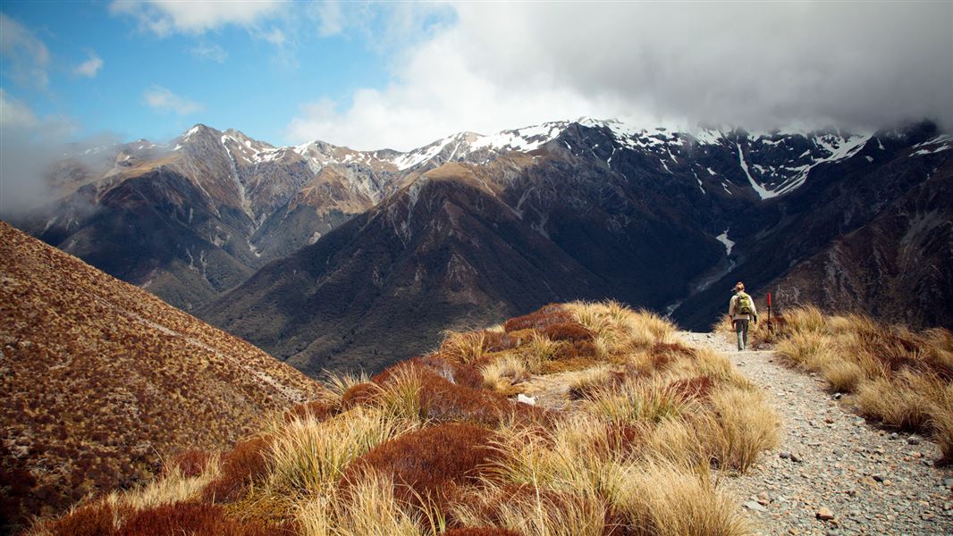
About
The track gradient is generally gentle, with some steep steps either side of Bridal Veil Creek.
Start at the Punchbowl, Bealey Chasm (Jacks Hut) or Temple Basin car parks to walk all or part of the track and return the same way.
From Punchbowl car park it’s a 20 minute walk to the Bridal Veil Falls lookout through subalpine mountain beech forest and Dracophyllum to a small clearing with a picnic table, good views of the falls, surrounding peaks and Arthur’s Pass village. Note the intense red leaves of the Dr Seuss-like Dracophyllum in spring/summer.
After crossing Bridal Veil Creek, the track travels through alpine shrublands and wetlands before reaching Jacks Hut – a restored roadman’s cottage.
At Jacks Hut cross SH73 to Bealey Chasm car park and follow the track through old-growth mountain beech – a good place for bird watching.
At the intersection with the Dobson Nature Walk turn right to cross the road again to the Temple Basin car park or turn left to follow the Dobson Nature Walk to the Arthur’s Pass lookout on the summit of the Pass.
From here look across the road at the Dobson Memorial – commemorating Arthur Dudley Dobson, the surveyor who gave the modern name to Arthur’s Pass. This is the highest point on the road before it drops to the West Coast.
Return on the same track. The main highway is unsafe to walk on and should not be used.


